February 1st, 2024
Mt. Massive Ridge Traverse
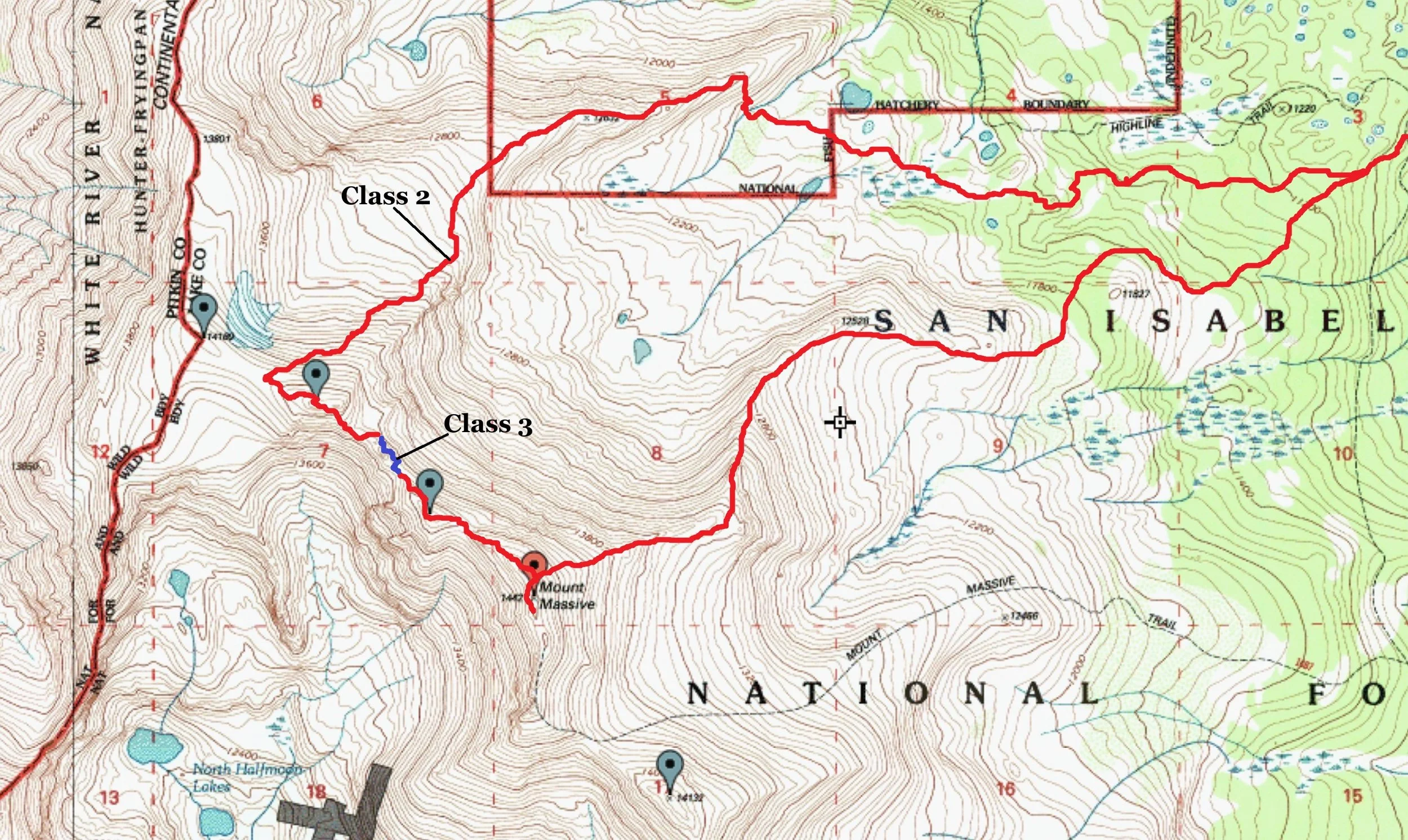
East Shoulder/Northwest Ridge- Class 3
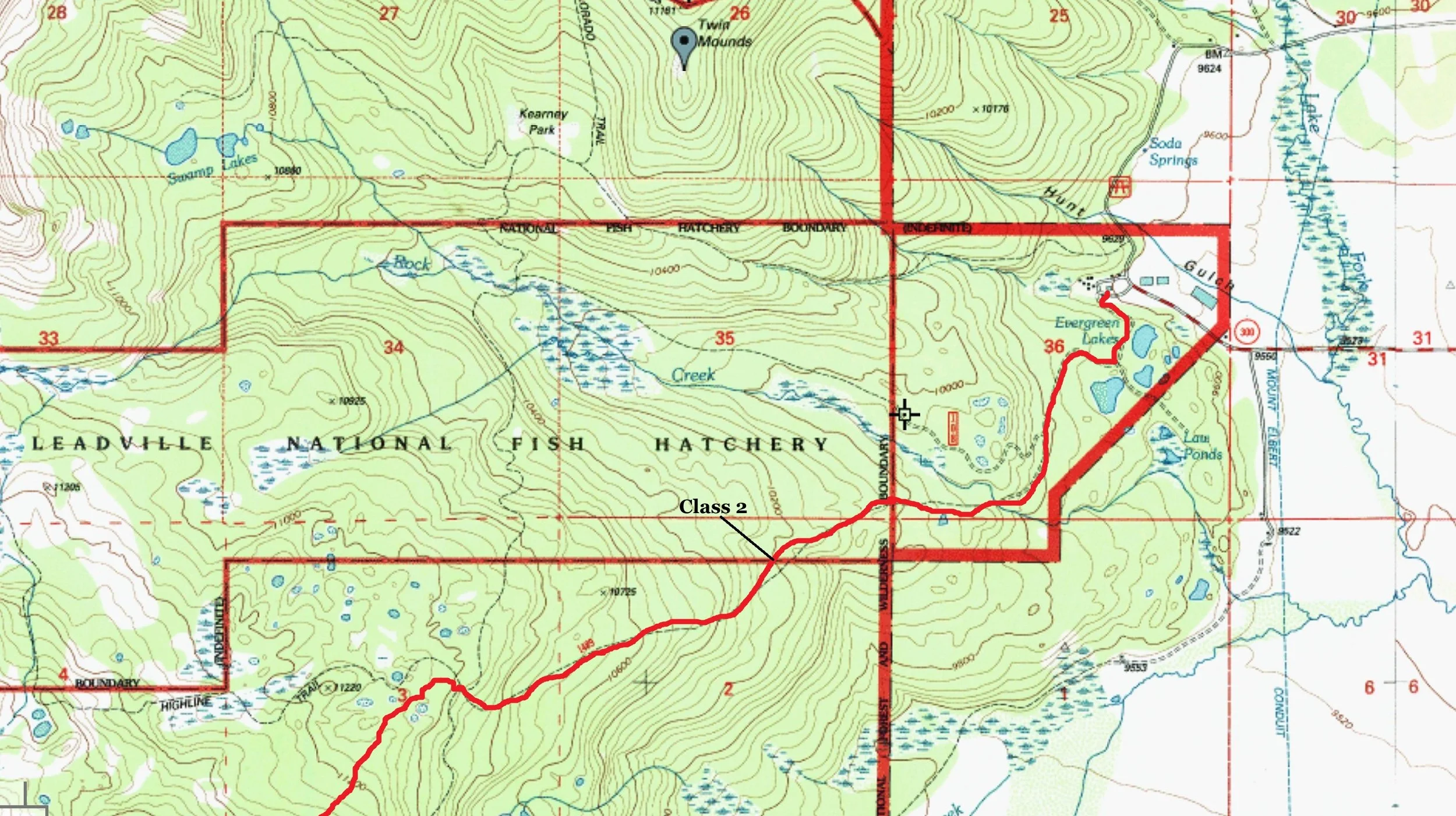
Trailhead- Fish Hatchery
15.92 Miles | 5,745’ gain
Starting elevation- 9,600’ | Ending elevation- 14,427’
Kiefer Thomas (solo)
I’ve been up Mt. Massive in winter before. Ben Connors and I set foot on its lofty summit back in December of 2010...seemingly a lifetime ago. However, in my feeble and iterate attempts to gain access to the elusive Frozen Fourteeners club, I still needed “North Massive” (14,337’). Although this summit is technically unranked, carrying 274’ of prominence, there is a healthy contingent of people that include it on their winter lists; I am one of them.
If there was going to be a season to knock off some of these peaks, winter 2023/2024 would be it. However, with recent job insecurity, then falling victim to that insecurity, finding new employment and moving to a new city, I simply couldn’t find the time to take advantage of a great winter. And sadly, chalking off another spin around of the sun this March, the haste in seeing this objective completed has an increased margin of gravity to it.
There was a virtual highway stamped through the forest up to the lower flanks of Mt. Massive. And even though I had planned on another assault of Blanca Peak (from an earlier failed attempt), I just couldn’t pass up a trench of such magnitude. And with a major storm forecasted to roll through the state the next day, I guess I was Arkansas Valley bound.
I left Purgatory at 1:00 am with mug o’ coffee and burrito from PJ’s (small grocery store in Hermosa) and arrived at the Leadville Fish Hatchery at 5:12 am. It was a bit later than what I would have chosen, but the drive from Hermosa to Pagosa Springs is a shooting gallery of deer, elk & turkey in the predawn, and I like my auto insurance premium right where it is. The fish hatchery is the standard trailhead for winter approaches. It was a brisk 6° outside and I was the only car in the ample parking lot.
I had read a recent conditions report saying that flotation wasn’t necessary. But let’s face it, would YOU head into the backcountry in winter without some form of flotation? I sure as shit wouldn’t. That’s something I’ve never been comfortable with. I know these aspects are a bit rhetorical, but what happens if the weather takes a poop on you? What do you do if you decide to take a different descent route or you become lost & disorientated? Regardless if there’s a trench already in place (preferred, obviously) or if I’m making my own, I’m taking pontoons (‘snowshoes’- thanks Bill for that GREAT word!) or recently, AT skis. Without flotation, a mundane trip can easily become an epic involving SAR. And I’m fairly confident in saying...no one wants that. It’s always better to have and not need than need and not have. In my years of venturing outside in the winter, ‘even if you lay em’ down, sometimes the cards still aren’t worth a dime’ despite what Jerry Garcia says.
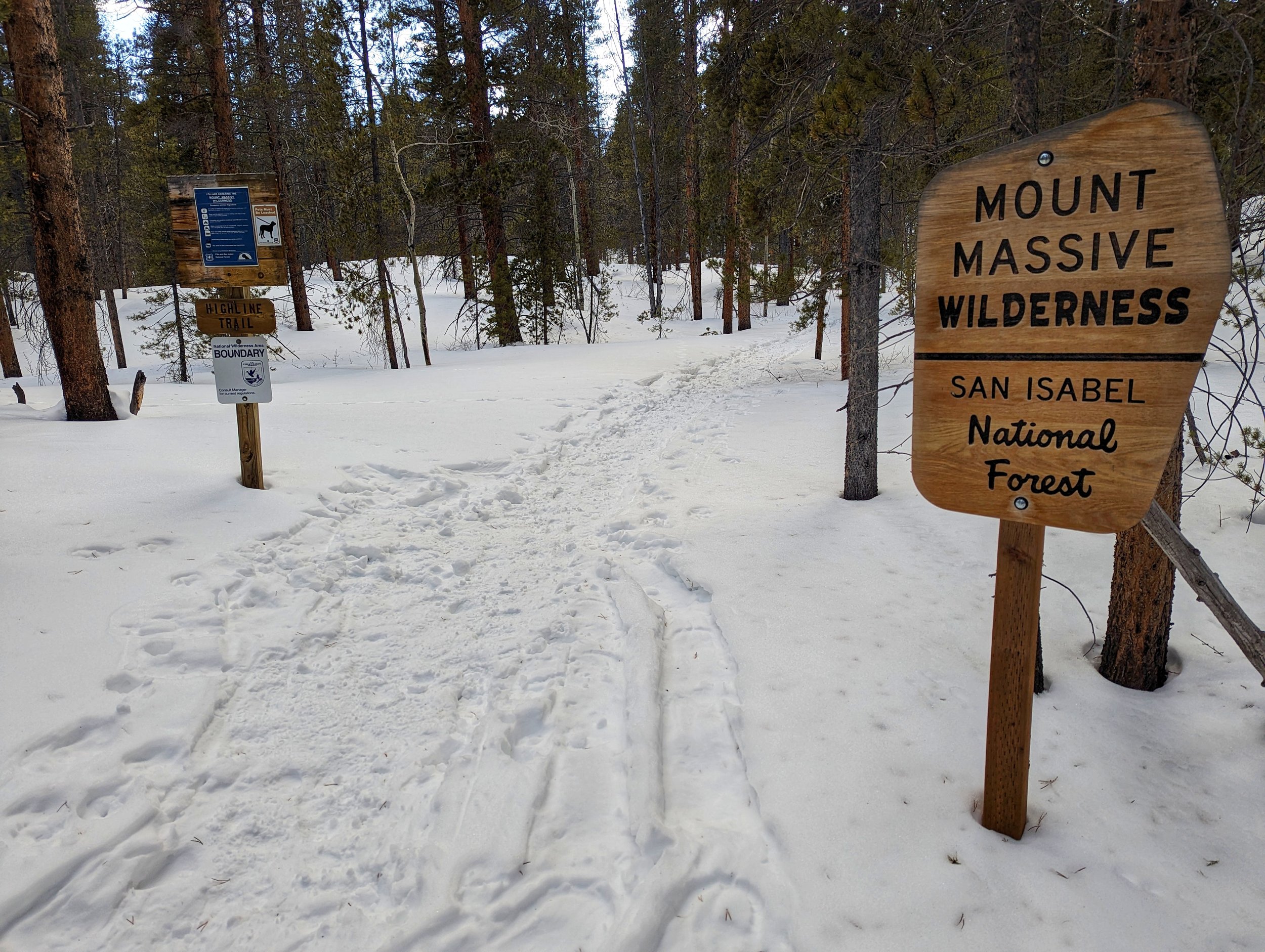
Once you leave the access road from the fish hatchery, the track splinters into multiple trails that radiate out like squirrelcats (yes, that’s a word). This was my fourth time in these woods in winter (I tried last season but was thwarted due to weather) and I still managed to get lost. It honestly seems just getting past Evergreen Lake is the crux. I backtracked a bit, found a trail that was better trod, and followed it to a trail junction that I remembered. In the pitch black, the floating snow and ice crystals falling from the trees floated through my headlamp beam like phytoplankton in the abyss.
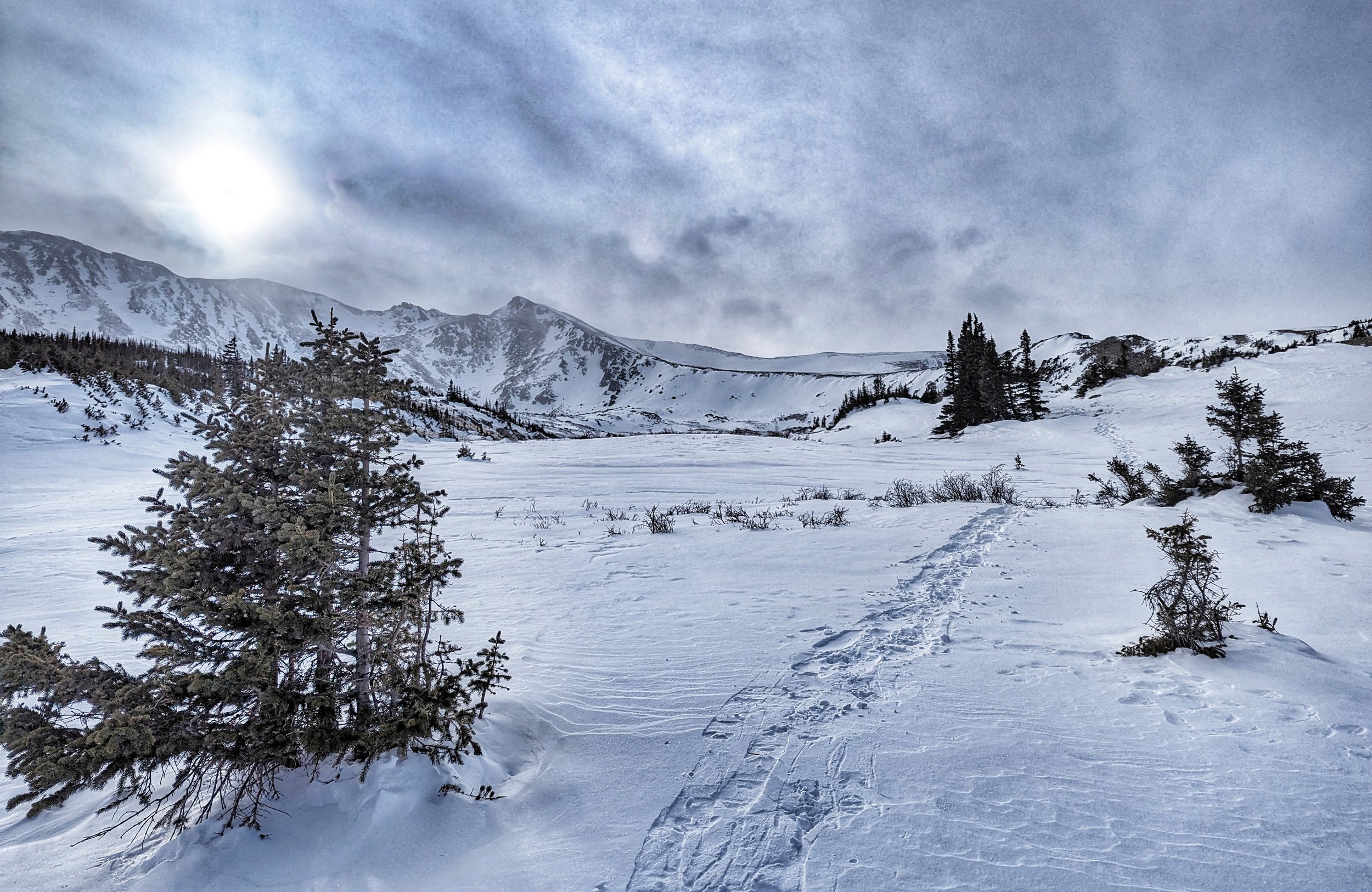
It ended up being 3.5 miles to the trail junction I needed. The Highland Trail (which I followed) and Colorado Trail is marked by a single, solitary post. I imagine in summer; this is an easy place to find. But in winter, it’s sadder than a weeping willow and easily missed. I stopped long enough to swig some fluids, stomp the snow around the post and switch my phone over from podcasts to some music (I’m rather fond of 90’s industrial). I turned my headlamp off for a few minutes to adjust my eyes. And like a photograph, the trees and stars started to develop before my eyes. I stopped for a bit longer about 15 minutes up the trail at a small bluff overlooking an unnamed pond. The weather was still gorgeous and clear. I decided to done snowshoes at this point even though I could have continued without them. The snow wasn’t as supportive as I would have hoped for, and every footprint felt like a drunk disco step.
At 8:40 am. I arrived at treeline. Strava was saying 5.25 miles. It felt like I was moving slower than normal. But considering I haven’t been out this winter at elevation and the skiing (in the San Juan’s) has sucked, I considered it a moot point. The weather, however, was still fantastic. Even at 12,000’ in Colorado, if it’s sunny and 15° outside, consider it T-shirt weather!

Descending along Mt. Massives’ East Ridge
The route from treeline to the summit of Mt. Massive is straight-forward. I basically stayed the mellow shoulder straight to the summit. From treeline, I could see the entire the route and what to expect. But I kind of lingered here for a bit despite knowing, I still had quite the march in front of me. I don’t care what mountain I’m on, being in this magical frontier in winter, sun or snow, storm or stress, the views, and feelings of being somewhere that typically only exists in magazines or online articles for a lot of people is pretty cool.
Halfway up the shoulder, I came to a small outcropping of large boulders. I could have descended and gone around, but what fun is there in that? So, I scrambled up to the boulders, found that I couldn’t go over them...but I could go through them! I found a small passage that wiggled through them and did exactly that. I had to take my pack off to fit, but it was a small whit of fun that helped to break up the menial, maddeningly monotonous march up the slope.

The summit weather, save for it being a might bit crisp when the wind kicked up, actually wasn’t that bad. I stayed long enough to attach a summit register and drink from a fire hose of mountainous landscapes. I still had what was probably going to be a semi-long traverse ahead of me. But I won’t lie. Turning my back on “North Massive” and absconding to Frisco to spend some quality time at Outer Range Brewing was VERY tempting. Since the ridge was going to be an easy class-2 cruise, I might still find time to be able to put back some calories by way of some tasty DIPA’s and NEIPA’s.
The first portion of the ridge went by without merit. It was an easy cruise of jumbled holes and snow. Being buffeted by the wind didn’t even really phase me. It was a rocky cruise but mostly flat. Then I came to a point, a few hundred meters in, where the ridge dived down quite suddenly. After initially scrambling the rock, I decided to alter into a snow-filled cleft for more stable purchase since the rock was covered in light rime.
The ascent up to “Massive Green,” a name I believe, that might have been bestowed by a one, Gerry Roach, was pretty easy. It was a mild slope with good snow. I uncovered a semi-broken summit register that needed some TLC. Unfortunately, I had none to give. For the first time all day however, I felt like I was making fairly decent time.
I lingered there really studying the ridge traverse over to “North Massive,” all the nooks, steep side slopes, snow layout and somewhat loudly proclaimed, “Bullshit!” There’s no way that’s class-2 I thought. I should probably start looking up the routes I intended to do. I know it takes the surprise out of the...surprise, but sometimes, I don’t want to be surprised. Oh, well. I’ll manage.
I was semi-following some tracks across the ridge and on the descent off “Massive Green,” (14,311’) the tracks were more regular. I figured, if someone was on this ridge, probably in the last couple days, they were more than likely aiming for “North Massive” as well. So, I followed them. Not having to think and make critical route-finding decisions is pure bliss sometimes. As I found out shortly after, Turbo Tiff and Climbing Cue (Bill) made said tracks. Many thanks guys for the crumbs to follow!!

Lower down on the East Shoulder

Mt. Massive with low snow conditions

North Massive
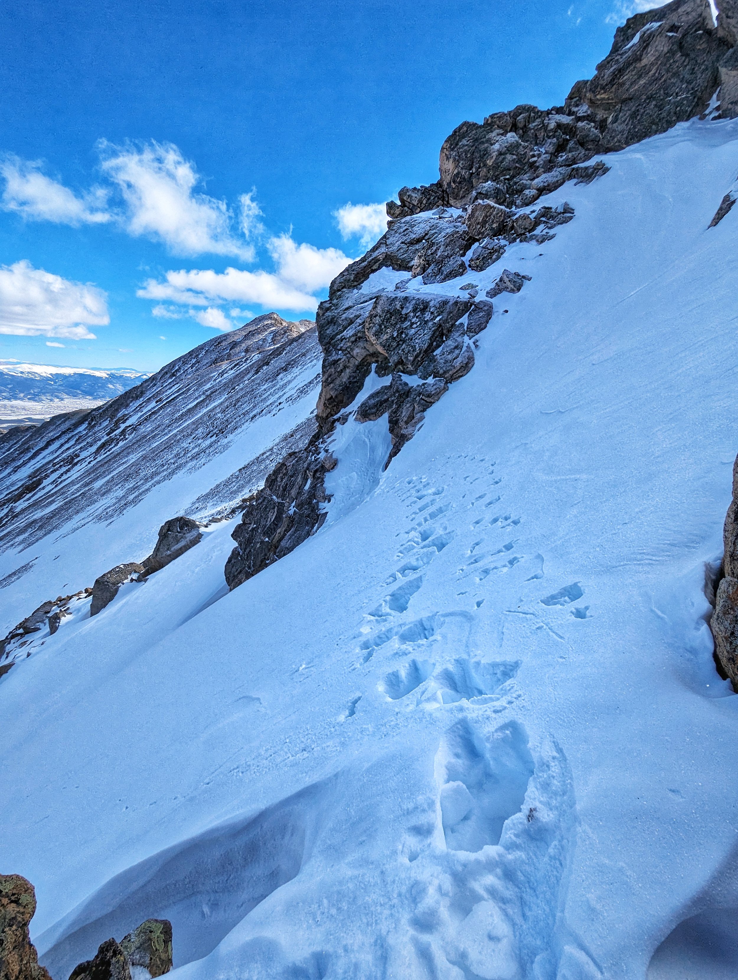
A sketch snow crossing on the traverse to North Massive
At the saddle, I aimed for the right side of an easy and broken ramp. I scrambled up this short section and popped out onto a shelf of snow that descended slightly to a massive boulder. Their tracks led to the edge of this grey pillar (basically a shallow moat) and wrapped around out of view. On the other side of this avenue, the tracks abruptly went up, and I mean UP! The first step involved a four-foot perch to get on the steep snow slope. I lingered here a bit considering my options. I could see the tracks climbing up the slope for four meters or so, then dog-legged straight across the slope to the other side. I didn’t have crampons or an axe with me. And of course, being able to see the bottom of the slope and what would befall me if the prior tracks gave out or the snow broke, didn’t really help things. But I thought, those tracks have been there for at least 24 hours, that’s a good amount of time to freeze and set. I still wasn’t thrilled with not having an axe (at a minimum), but I gave it a go. And it turned out, I was right. The tracks were just fine. Only twice did I have to restomp a footfall to stabilize it.
I ambled to the top of the ridge and saw the last piece I needed to scale. There were some large boulders and palisades to get over. I descended a bit to another saddle and spied a notch in the upper rocks. I had lost the tracks and I wasn’t keen on traversing steep snow. So I scrambled up the frozen scree and snow up into a tight notch that was mostly thin ice and snow. Using the sides of the boulders, I easily climbed up through them and popped out onto a wide tilted plateau. There was the summit and just below me, there were their tracks! I followed the mellow ridge crest and eventually joined up with their tracks whereby, I landed on the summit of “North Massive” 10 minutes later.
I sat down to some random snacks and enjoyed the view. The weather still wasn’t bad. There were some flurries, but they were being blown in from clouds much further west. It was actively snowing to the north but nothing of consequence. I packed things up and started to descend.
On the far side of the summit, there was a large snow ramp descending to a lower plateau. And right there, looking like a zipper, were their tracks leading down. Well, who was I to say to no? The summit of “North Massive” was quite enjoyable and better than I expected. The traverse likewise was fun and great. It’s something that I would gladly repeat.
As I was descending, I was replaying what I had spied to the north across the ridge. The northeast shoulder would make for a fantastic descent route. The upper basin was holding too much snow to make any early descent safe. However, near the terminus, there was a slope that was probably half melted out or wind-blown. I thought that would make for an excellent way off the shoulder. And as I was descending the open shoulder, occasionally crossing their tracks, Bill and Tiffany had the same idea. I followed some of their remaining tracks down the melted strip and eventually took my own course down by hugging the trees to my left, staying away from the open slope to the right. Near the bottom of the trees, I plunge-stepped to the bottom and started traversing to the east to the open flats. I crossed their tracks again and, in the willows, I put my snowshoes back on. Without them (or skis), the descent would have been nightmarish. Remember what I said earlier about always having flotation?

I followed their trench out through the forest in a southeast direction and as expected, their track met up with the trench from earlier. I passed two large areas that were stomped out from previous campsites. The hike out always seems to take forever, and this time was no different. But now that I have an AT set, going forward, I’ll be skiing out.
I’m happy to finally have “North Massive” done and of course, another repeat of Mt. Massive. And major props to Bill and Tiffany. They really sped up my day even if I didn’t make it to Outer Range. Oh well, another day. I’ll be three hours closer from Gunnison.

Mt. Massive true summit