Kendall Peak
South Ridge (via: Silver Lake Approach/Arrastra Gulch)
Trailhead- Mayflower Mine
6.87 miles, 2439’ gain
Kiefer & Regina Thomas
8.20.2023
Kendall Peak is a mid-13er with 1,148’ of prominence in the Howardsville Quad. It is not the easiest destination to get to nor is it the hardest. If one doesn’t have a 4x4 vehicle to drive up Kendall Mountain Road out of Silverton (San Juan County #33), there’s going to be some extra mileage involved. Most folks start at the Titusville Mine on the west side. From the end of the road, the summit of Kendall Peak is only a paltry 651’ away. But again, that’s only if someone has a 4x4 vehicle. I imagine someone could feasibly drive a Subaru or comparative vehicle up the road, but it’s going to be an exceptionally rough drive. It’s even slow for trucks and Jeeps. However, if one doesn’t mind some extra mileage and an easier, 2-wd trailhead, there is a backdoor to Kendall Peak that grants the explorer the opportunity to walk through some history, literally.
Arrastra Basin is roughly five miles from Silverton. But because of the topography, one must wrap slightly north on County. Road #2 (towards Animas Forks) until County Road #52 pops up on the right across from the Mayflower Mill. Then its a couple miles back south into Arrastra Basin. The road is significantly better than Kendall Mountain Road with whispers of past grading. Plus the 2-wd trailhead is much higher than where one could reasonably park for the alternative. There is an upper 4x4 trailhead as well at the Mayflower Mine that allows some to park an additional 600’ higher. But take note, this section of road is narrow, one vehicle in width with no place to turn around or pull over.
Regina and I left Purgatory at 7:00 am and parked around 8:15 am at the only switchback on the upper 4x4 section of the road. There’s only room for two vehicles here (it’s quite an elevated little perch) and we became the second.
Regina started off first up the road while I stayed behind and shored up the tires and marked the edge of the slope to make it less precarious to back up at the end of the day.
There isn’t much left of the Mayflower Mine which I thought was odd considering how profitable it was (but isn’t that always the case?). But my God…the mining debris and skeletal remains of past structures littering Arrastra Basin is astounding. I’ve traveled to Silverton many times to hike and off-road for the better part of two decades. But seeing the sheer amount of mining detritus in this basin really kind of glued everything together for me. What I mean is, having explored places like: California Gulch, Howardsville & Eureka, Animas Forks and the Denver Hill plateau, I’ve seen a lot of mines and discarded evidence of richer times. Arrastra Gulch tied everything together and made me realize exactly how important and vital Silverton was to the San Juan’s and the industry in general. For 60+ years, the town was a mountainous Ft. Knox. So as I was hiking up the road to where Regina was waiting patiently, I thought, ‘Silverton is but a shadow.’

We left the mine on a good social trail switch-backing constantly to a cliff band on the left. Attached to the rock, is a steel cable that one can hold onto that winds through a gash in the cliff band that skirts to the upper valley. There’s also a narrow ledge hikers left that will do the same thing without the benefit of a cable. This was the hardest part of the hike and not nearly as difficult as I read in some of the Silverton online hiking forums. But as is often the case, consider the source.
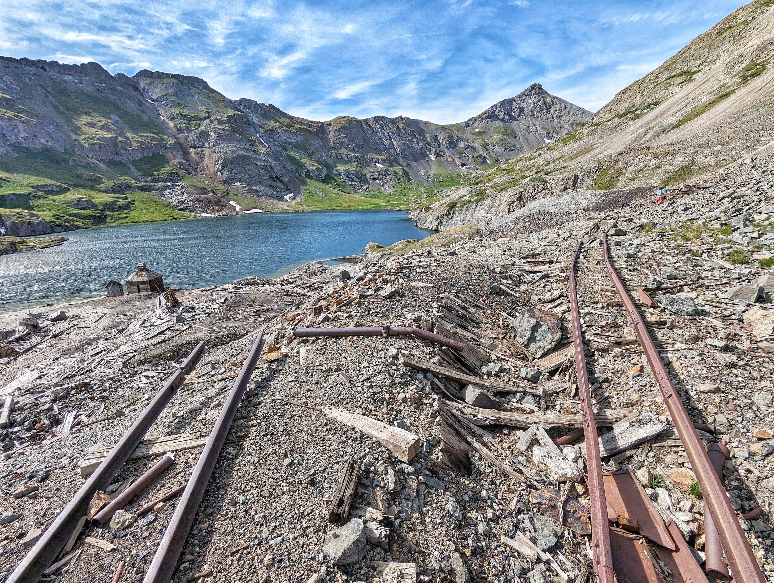
We caught up with the people who were in the Jeep that I parked next to. For a day hike, they had some MAJORLY big packs. Maybe they had camera equipment? We never found out. Regina and I angled to the right of Silver Lake and took a ‘trail’ (cough-cough) that weaved across the slag and talus piles created from mines above. The path took us across forgotten foundations, ore cart tracks, discarded wooden planks that looked like matchsticks, glass, nails, metal, the odd piece of steel machinery doomed to watch the land erode around it and the occasional gated vertical shaft. Indeed, this was a regular “No-Man’s land” surrounded by an ocean of beauty. As much as I love mines and mining history, this was one of the few times I muttered to myself of the atrocities laid bare on the environment from this industry. Silver Lake by the way is sterile; it’s too contaminated to support life aside bacteria. It reminded me a bit of the holding ponds east of Leadville up California Gulch that when I lived there, we called, ‘The Merlot Ponds.’ I guess arsenic, sodium cyanide, caustic soda & mercury will do that.
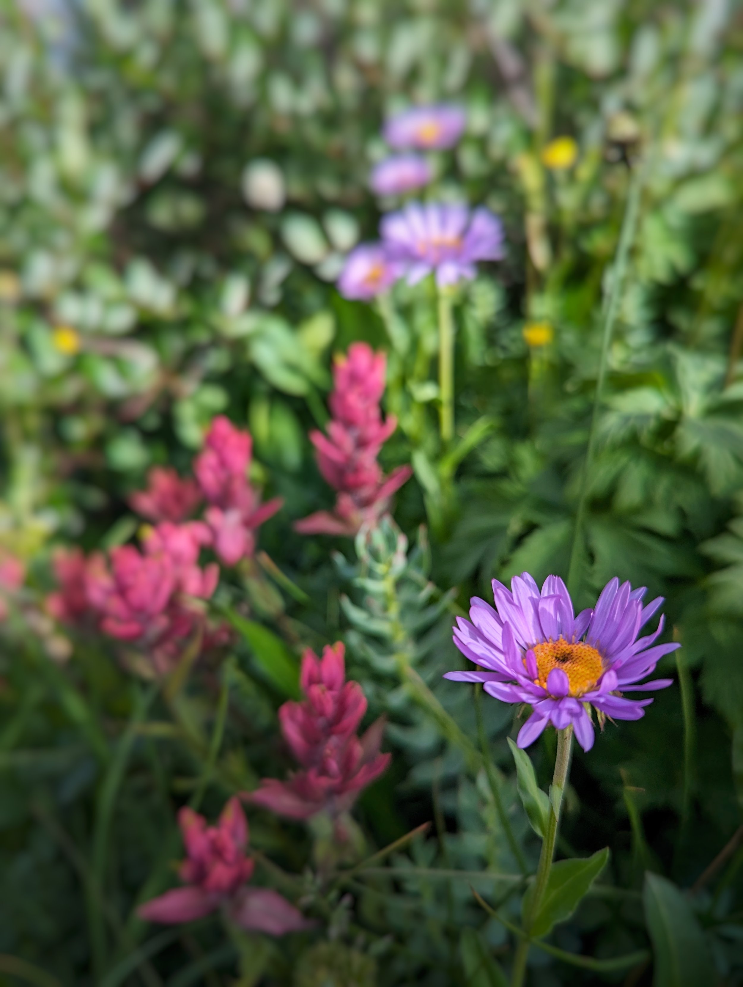
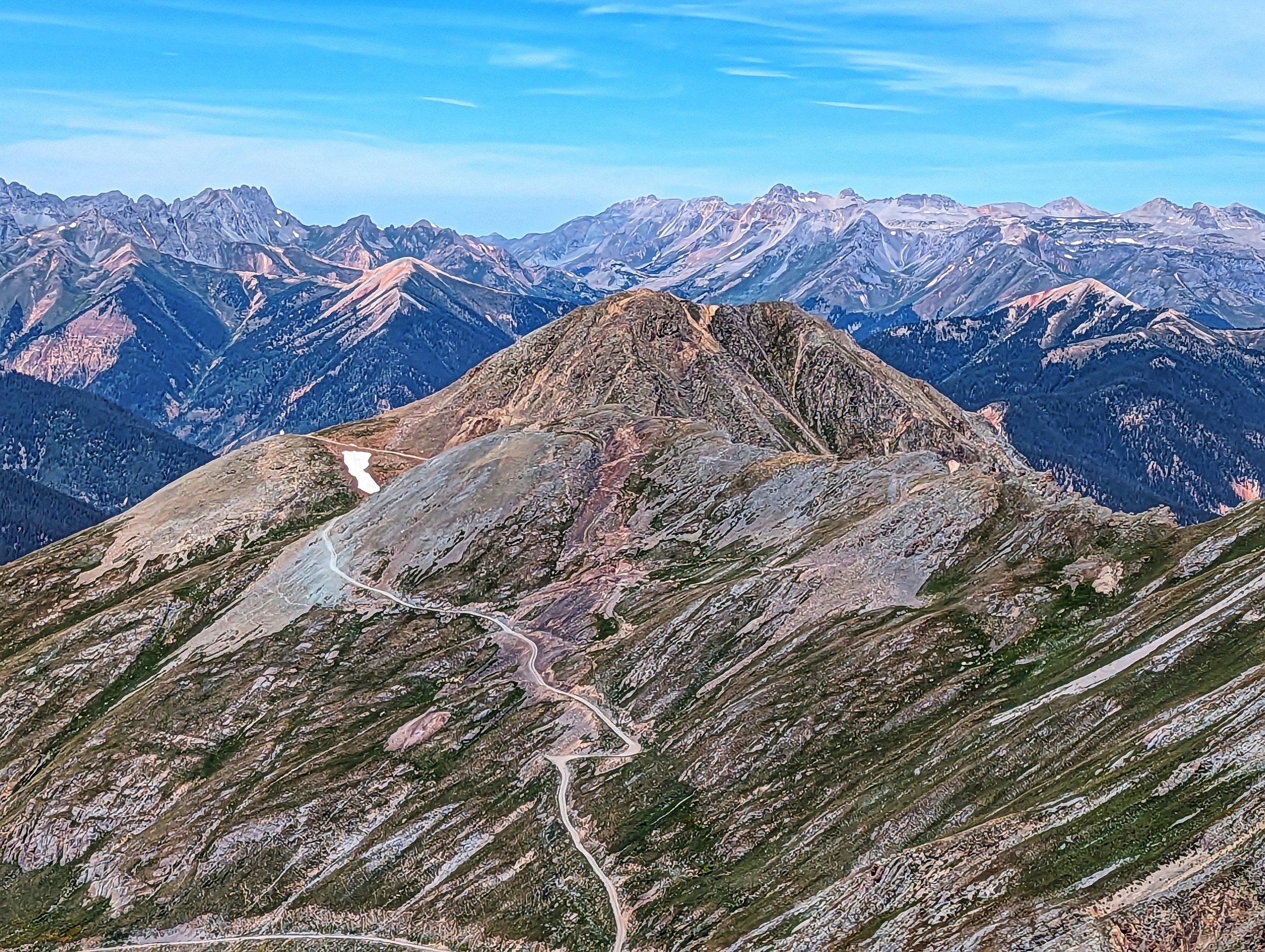
We plowed through fields of intense green from thick bittercress, stitchwort and sky pilots. Yellow explosions from Old Man of the Mountain dotted the head of the valley like freckles. The ground at times, being spongy from all the hidden life-giving moisture. Where we could, we opted for the longevity of rock and dirt to save this fragile ecosystem. It didn’t take long to arrive at the saddle between Kendall Peak and “Spencer Peak.”


We dropped our packs and took to our Nalgenes. I was beginning to see the wisdom in Regina's choice of wanting to do Kendall Peak from this direction. The views down Arrastra Basin were idyllic. But equally impressive, was being able to look down upon Kendall Mountain Road and see Molas Lake, the campground area, Molas Pass and the Twilights without so much as even turning one’s head. I understood that Kendall Peak may have been the objective, but it wasn’t the reason for our selected journey.
The breeze brought with it, the sounds of footfalls approaching our perch. Soon, we were talking with a solitary runner who decided to stop and make merry. He was tracing parts of the Hardrock 100 and was destined for Highland Mary Lakes. We talked for a good long while and we bid him a fond adieu as we all left on our own paths.
Regina and I made the false summit and were rewarded with great views of the Kendall Mountain group. Kendall Peak was named for James Kendall (1871) who was one of the first prospectors in the area around Silverton. Why all three points of this massif were named after Kendall, I don’t know. But I’m assuming he probably spent many days at length exploring and opening this area for proliferation.
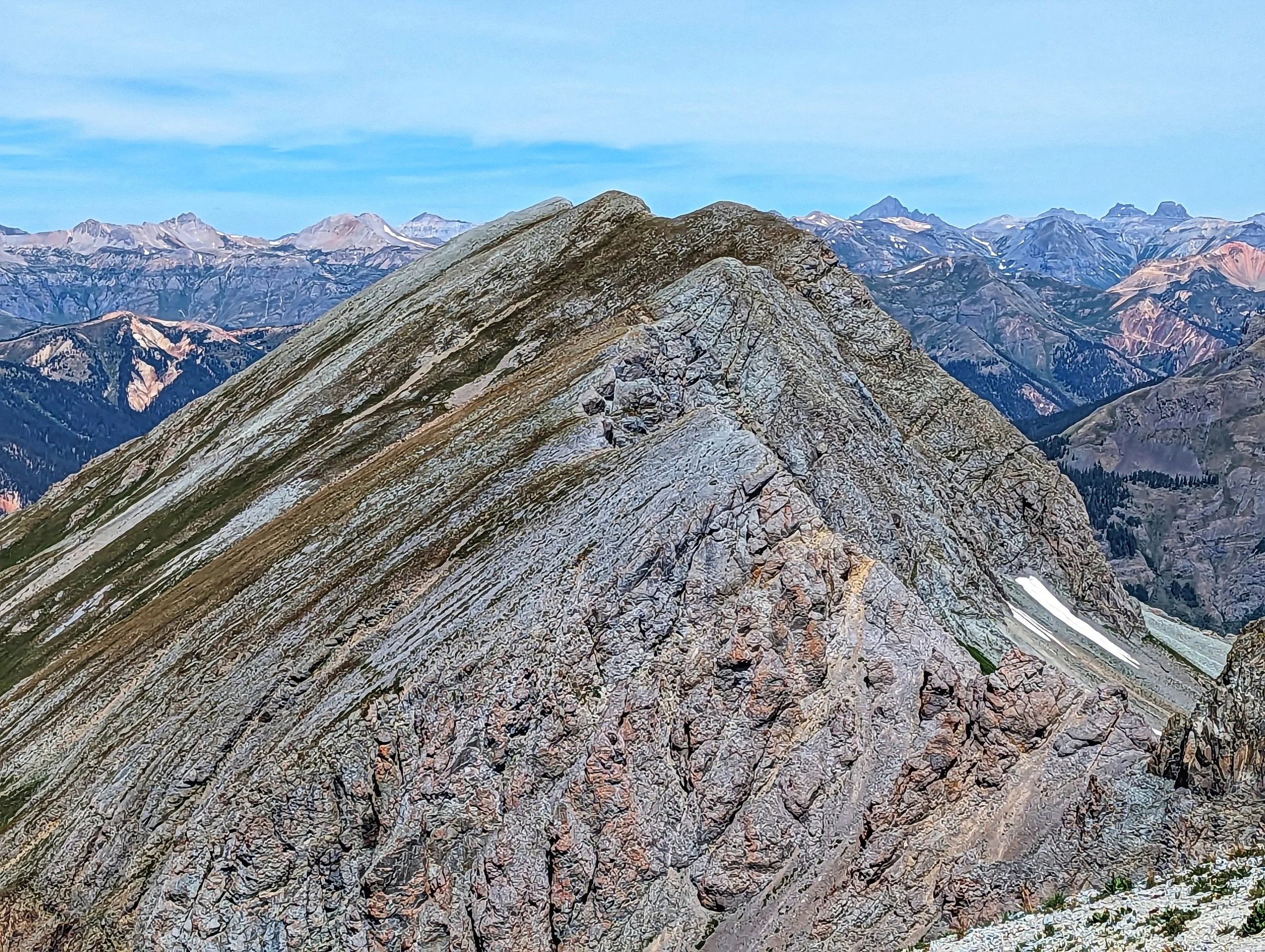
From our rocky nest, we could spy a faint trail pushing up to the apogee. Of course, from a distance, it looked impossibly steep. As we inched closer to the last and final push, the trail presented its true colors. The way forward was painted in easy grays, browns and the occasional resilient patch of green from wort and dwarf clover. The path pushed through the scree like a nicked blade but we reached the summit of Kendall and enjoyed a lengthy stay.
This was a peak Regina had been wanting for a long time. Last year when we did Kendall Mountain, we actually descended the ridge towards Kendall Peak to investigate the gash, to see if it was as bad as what everyone said. I’m here to report that, unless you’re a 5.10 climber, no one is getting across that craggy void.
We had no worries of the weather and we had no worries of descending. The summit was made that much more enjoyable because we chose the longer option through the area’s history. The summit of Kendall was a small, flat expanse with plenty of room for multiple people. After chasing thirty years of these mountainous pursuits, I relish finding the long way home from these endeavors. Not every summit is the best and not every summit is the worst. But each summit is its own. How we get there is open for interpretation. And what we do with that experience is how we grow in our wisdom for the mountains.
On our descent, which seemed rather quick, probably from lifted spirits, we stayed right of Silver Lake resulting in a circling of it. We followed some ancient cart tracks that were being swallowed by the tundra and skirted across the bones of the Royal Tiger Mine. Those same two gentlemen from earlier were up at the mine proper, above us. Once we reached the trail again, we continued around the lake staying closer to shore investigating the remains & dross of the mines and buildings. It was eerily quiet even despite the lapping of the water. The ambiance created an almost empty feeling. For those who have read Stephen King’s opus, ‘The Dark Tower’ series, there’s a line that Roland (the gunslinger) says repeatedly, “The world has moved on.” Walking along that forlorn shore, I could easily imagine the pathos of that line; sad, but impressive non-the-less.
We descended the trail quickly and made haste back to Silverton where we lingered at Avalanche Brewing. I’m a sucker for a good Oktoberfest/Märzen beer. It wasn’t the most expedient way to summit a peak, but again, sometimes the summit isn’t the objective, the objective is us.
Rocky Mountain Wildflowers
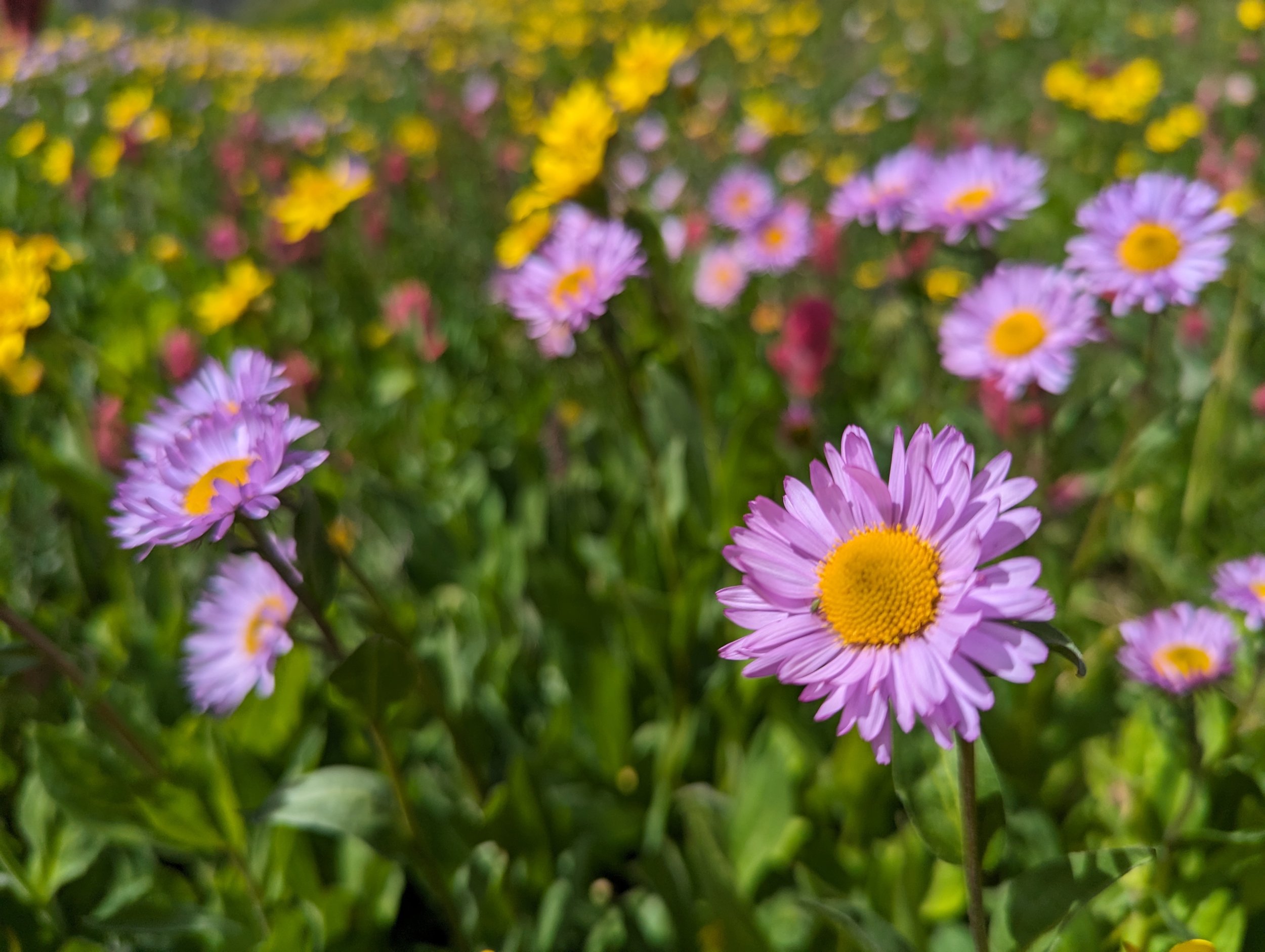
Rocky Mountain Aster
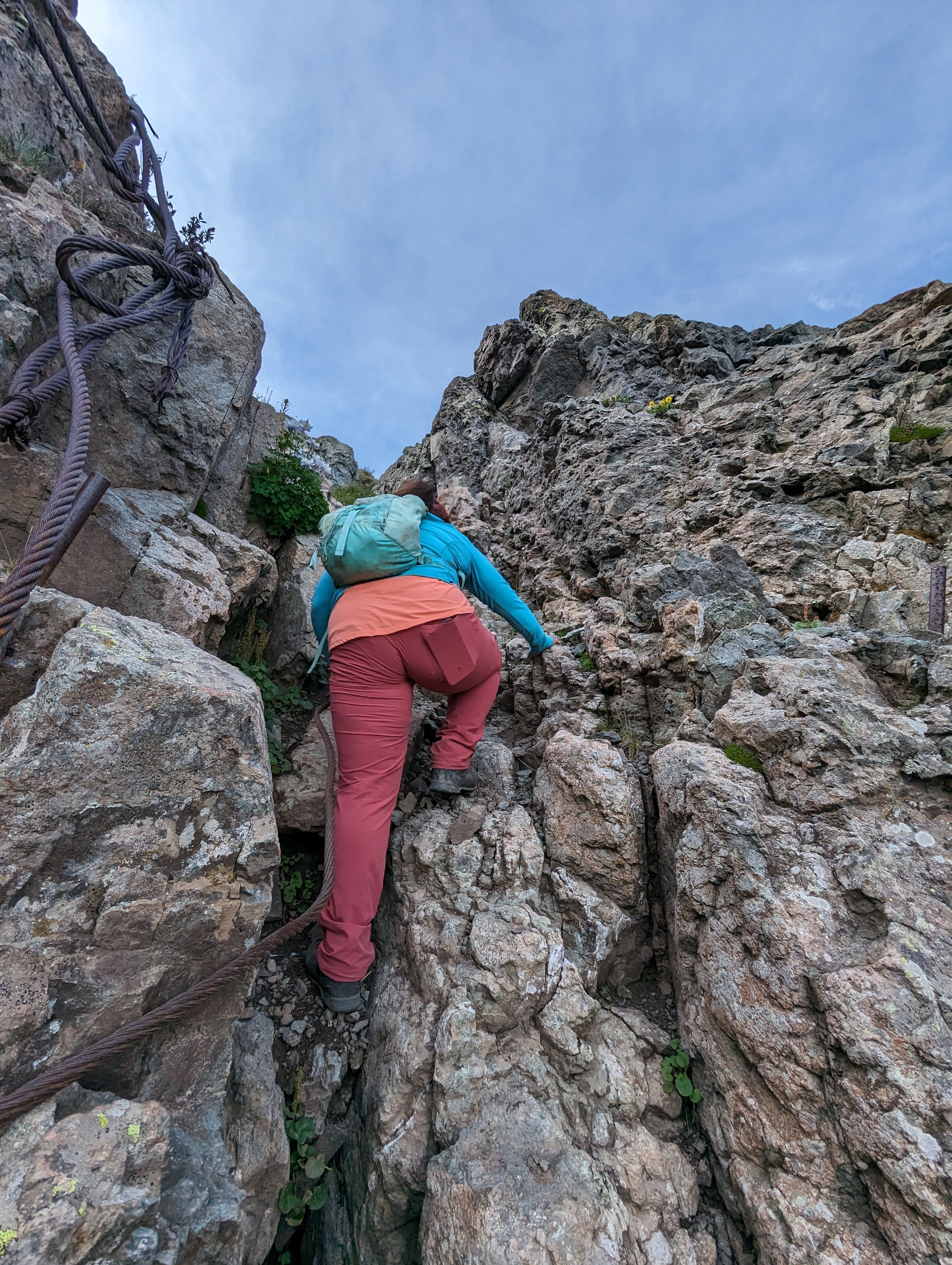
Regina climbing through the cliffs on the "standard" trail
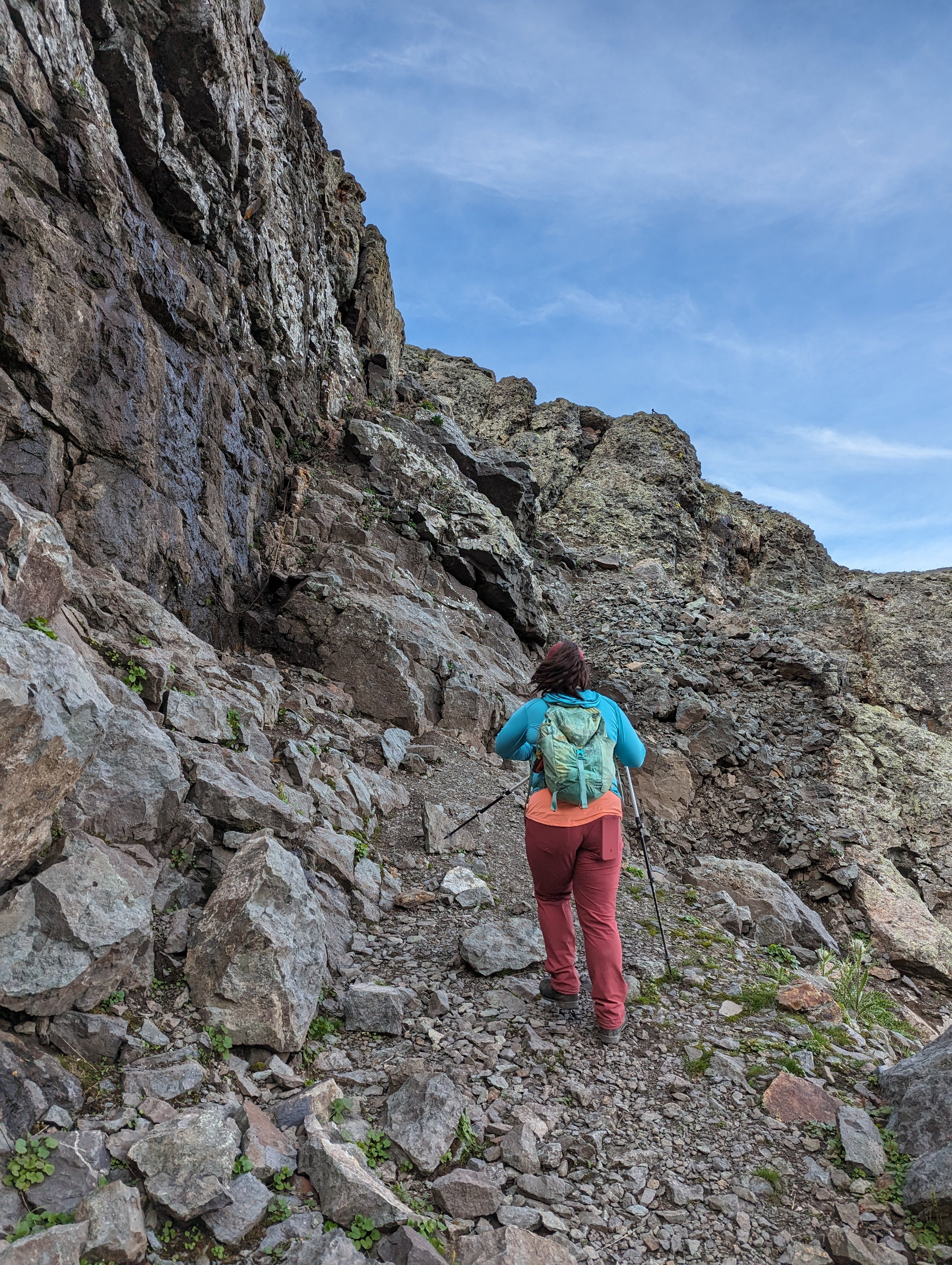
At the bottom of the cliffs.
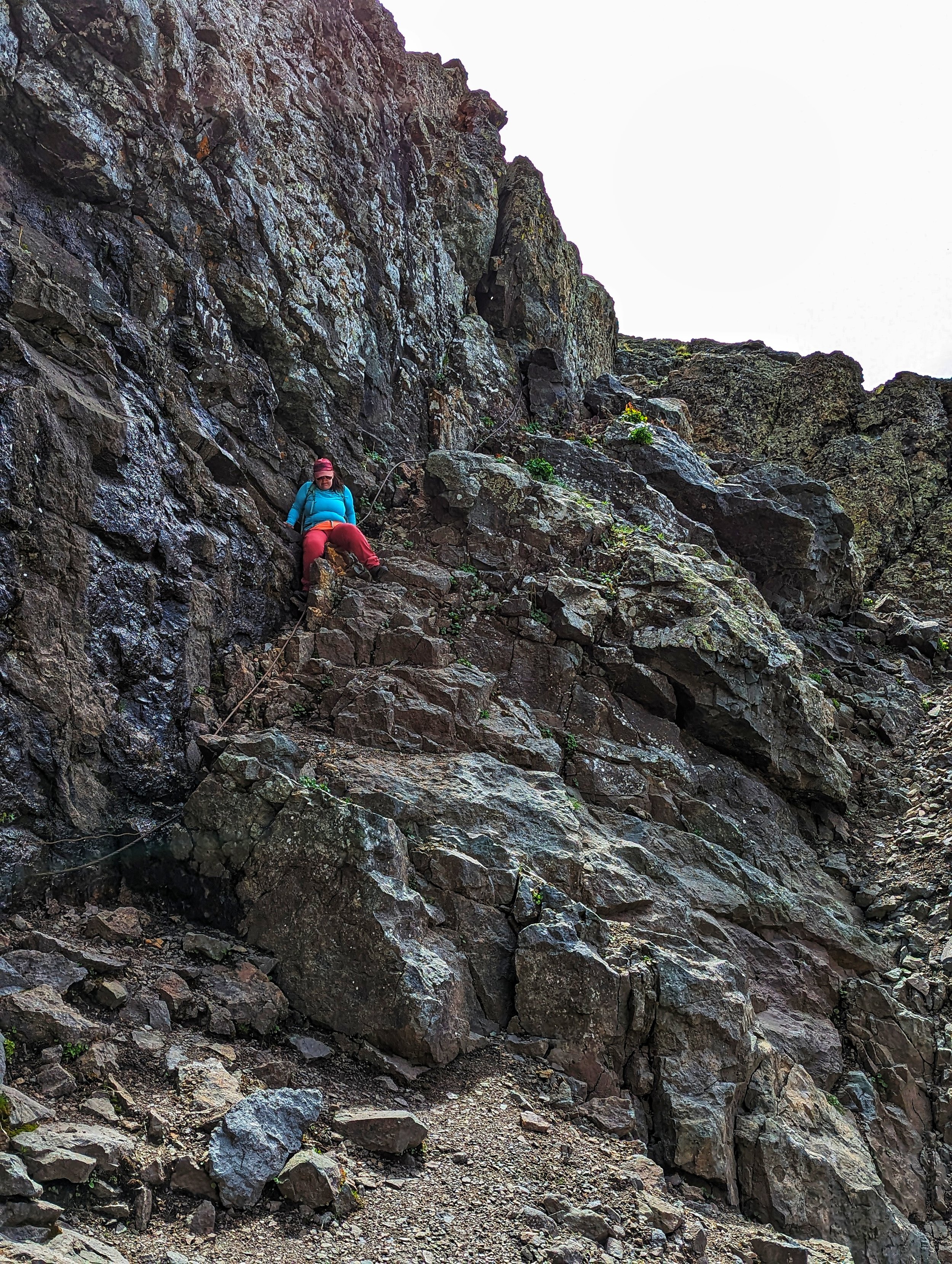
Regina descending the cliffs on our descent
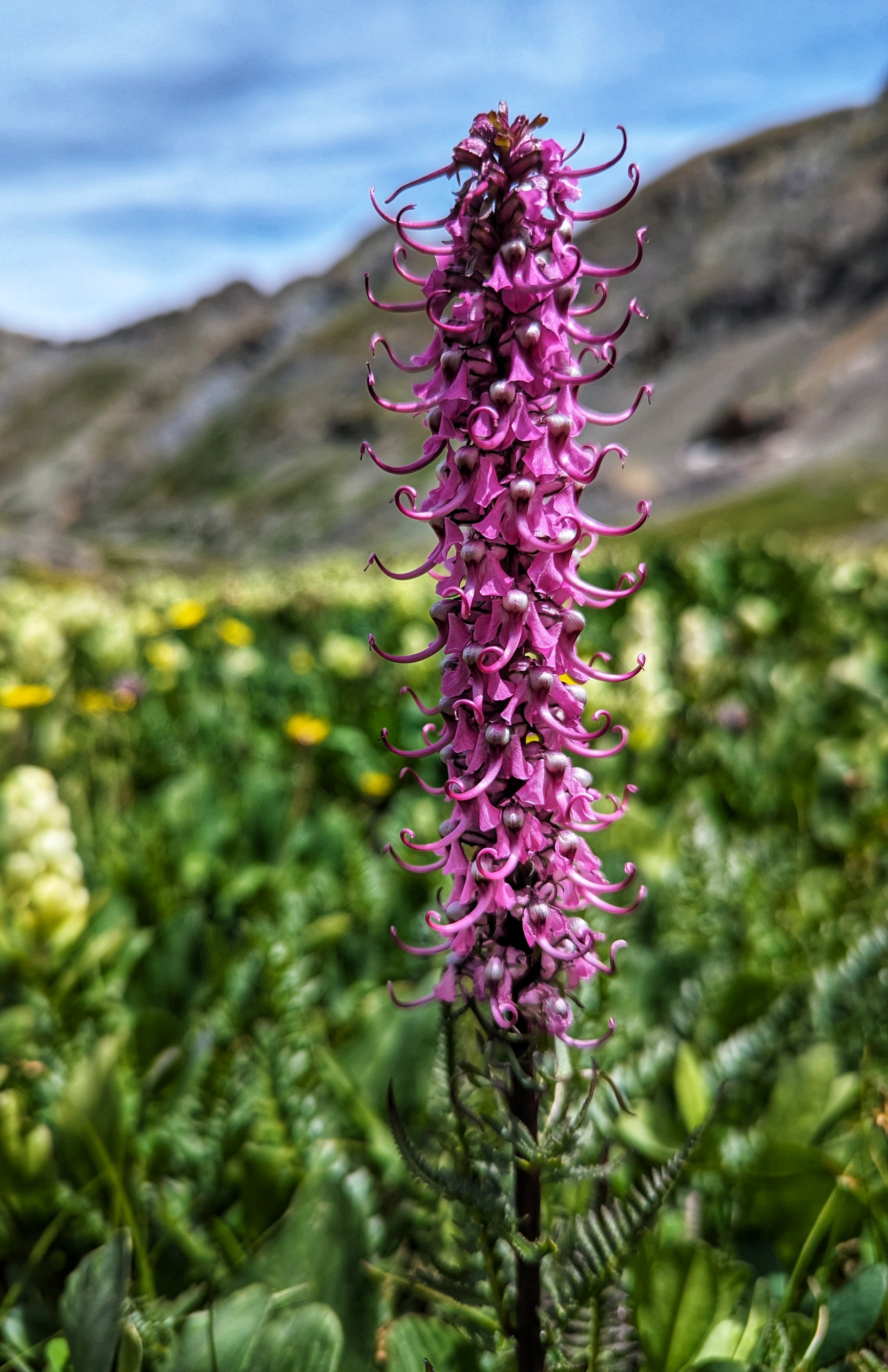
Purple Elephant Trunk
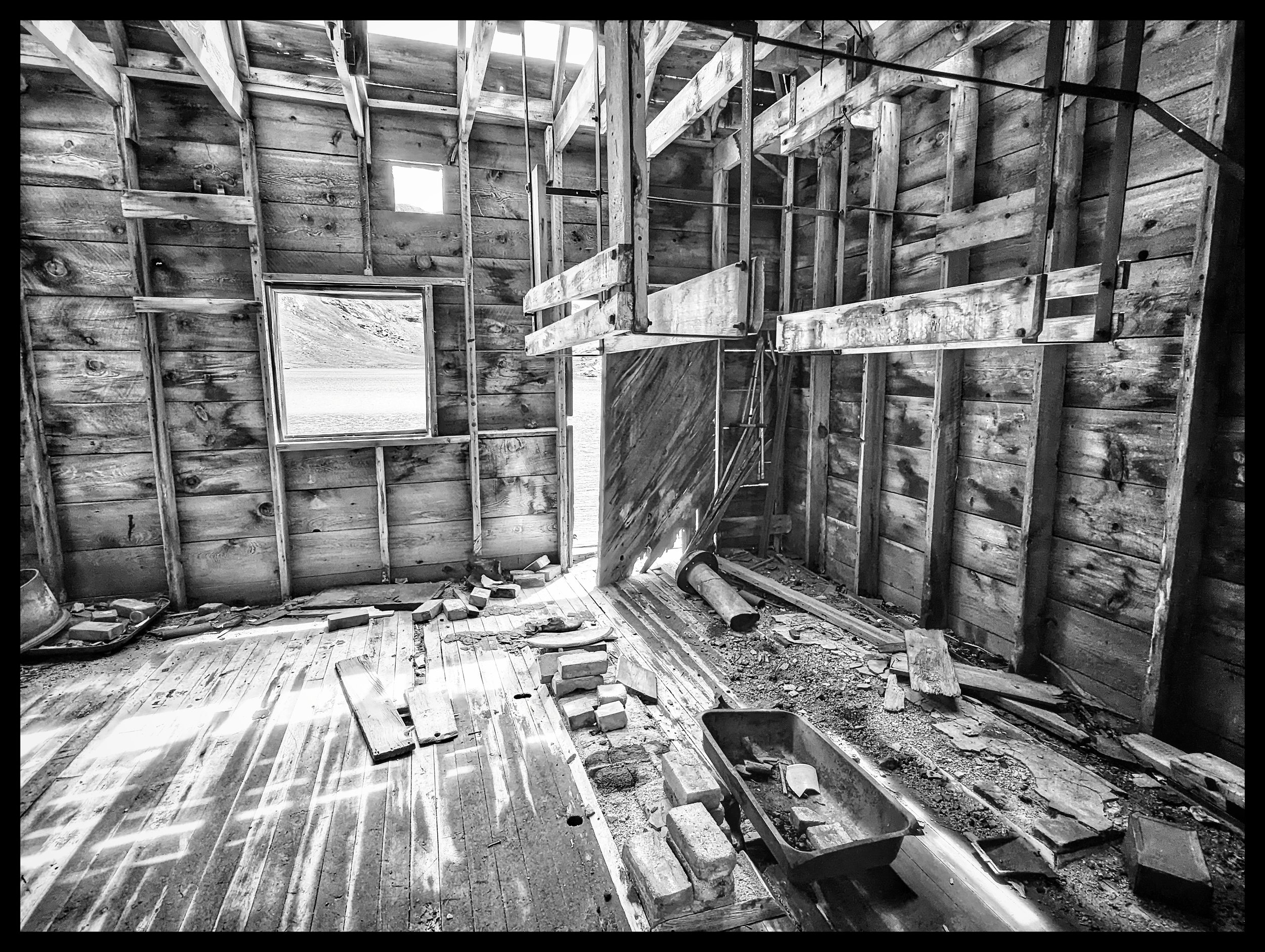
Inside the building at Silver Lake
Kendall No. #2 Benchmark (13,073'- just above Silverton)
Kendall Mountain (13,353')
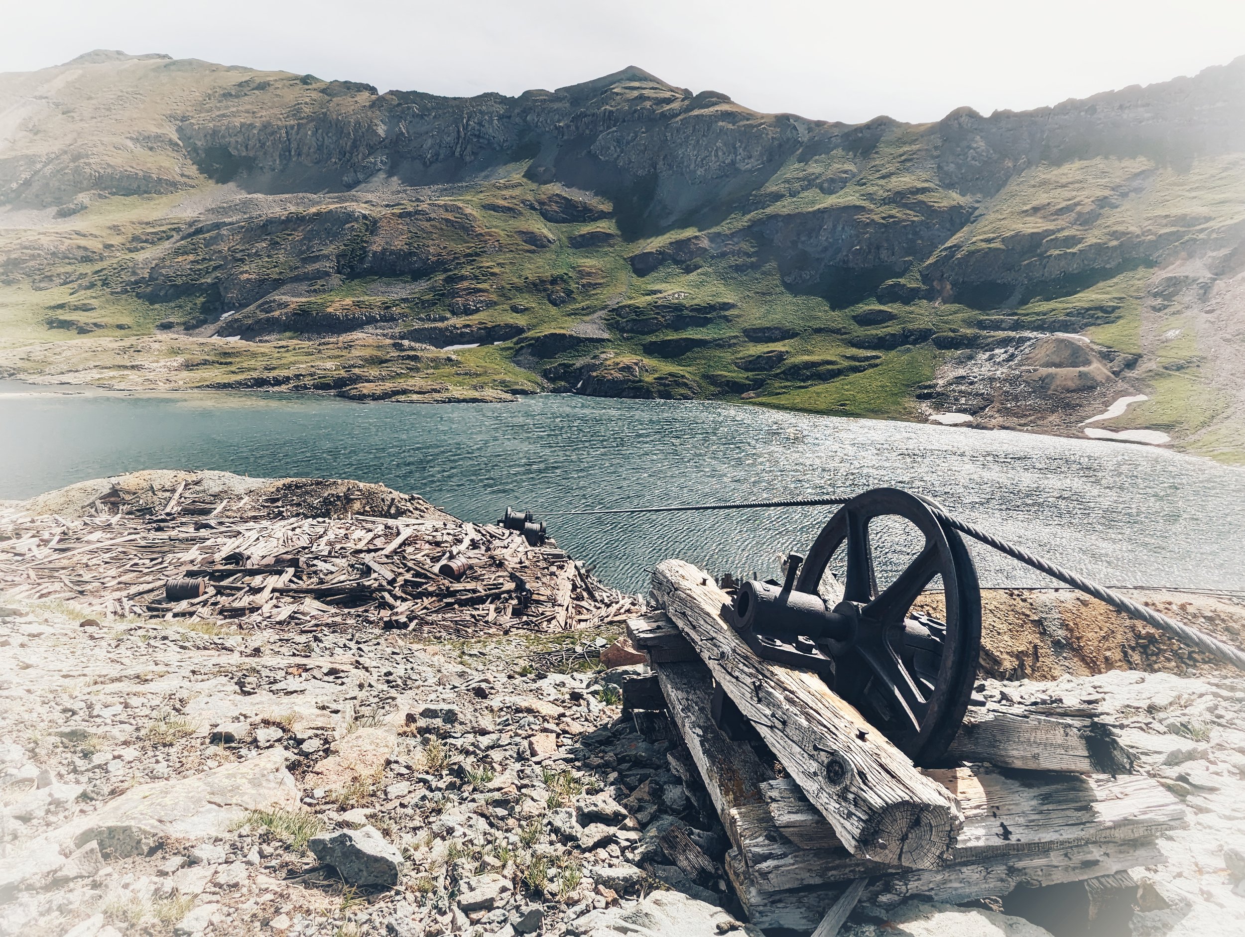
Mining debris at Silver Lake

Ore cart tracks at Silver Lake
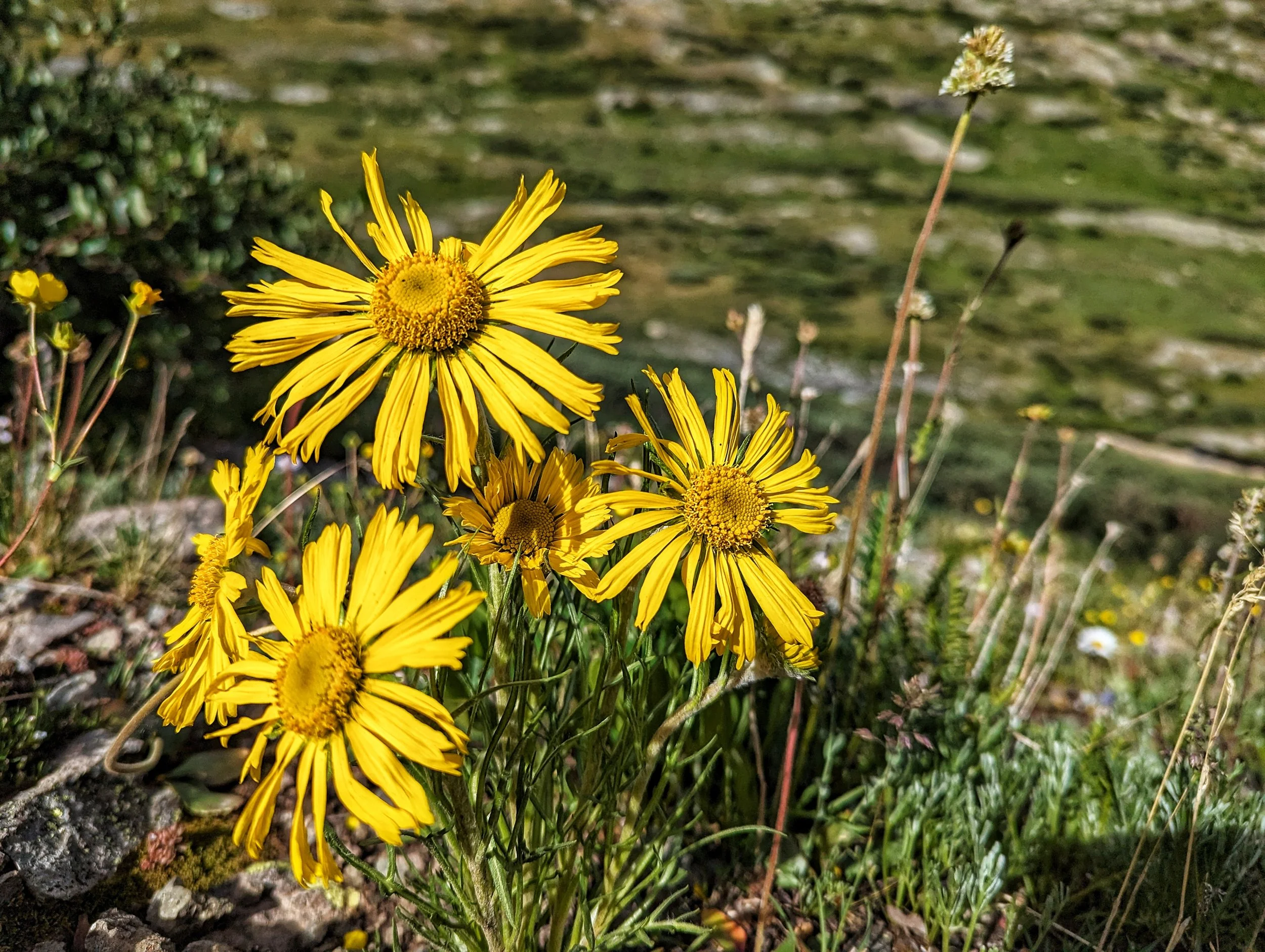
Old Man of the Mountain
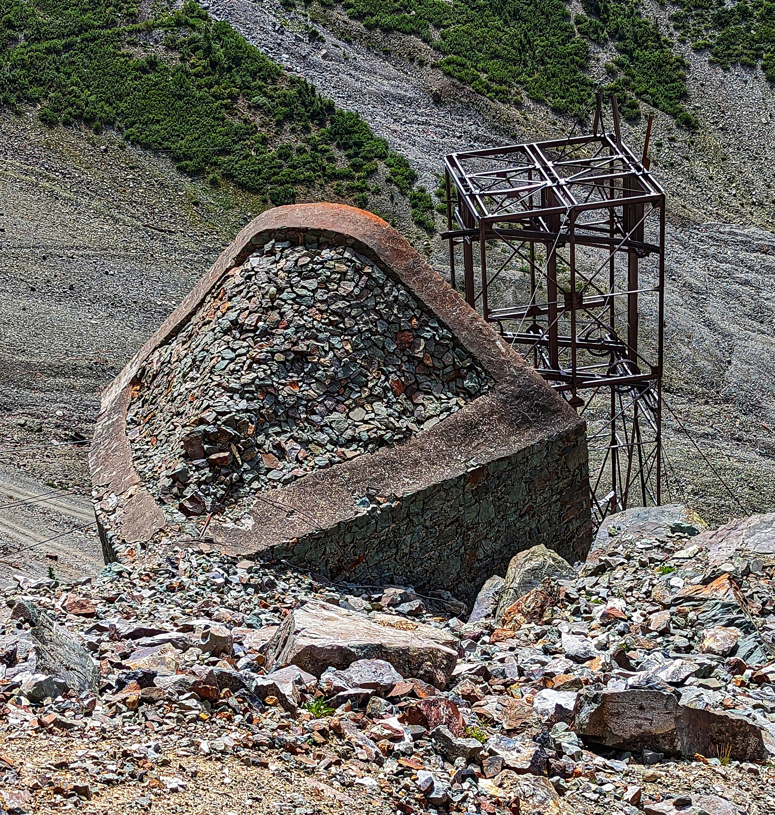
A support structure for towers long gone...

Summit selfie on Kendall Peak