Embrace the Choss!
Mt. Emma
August 4th, 2024
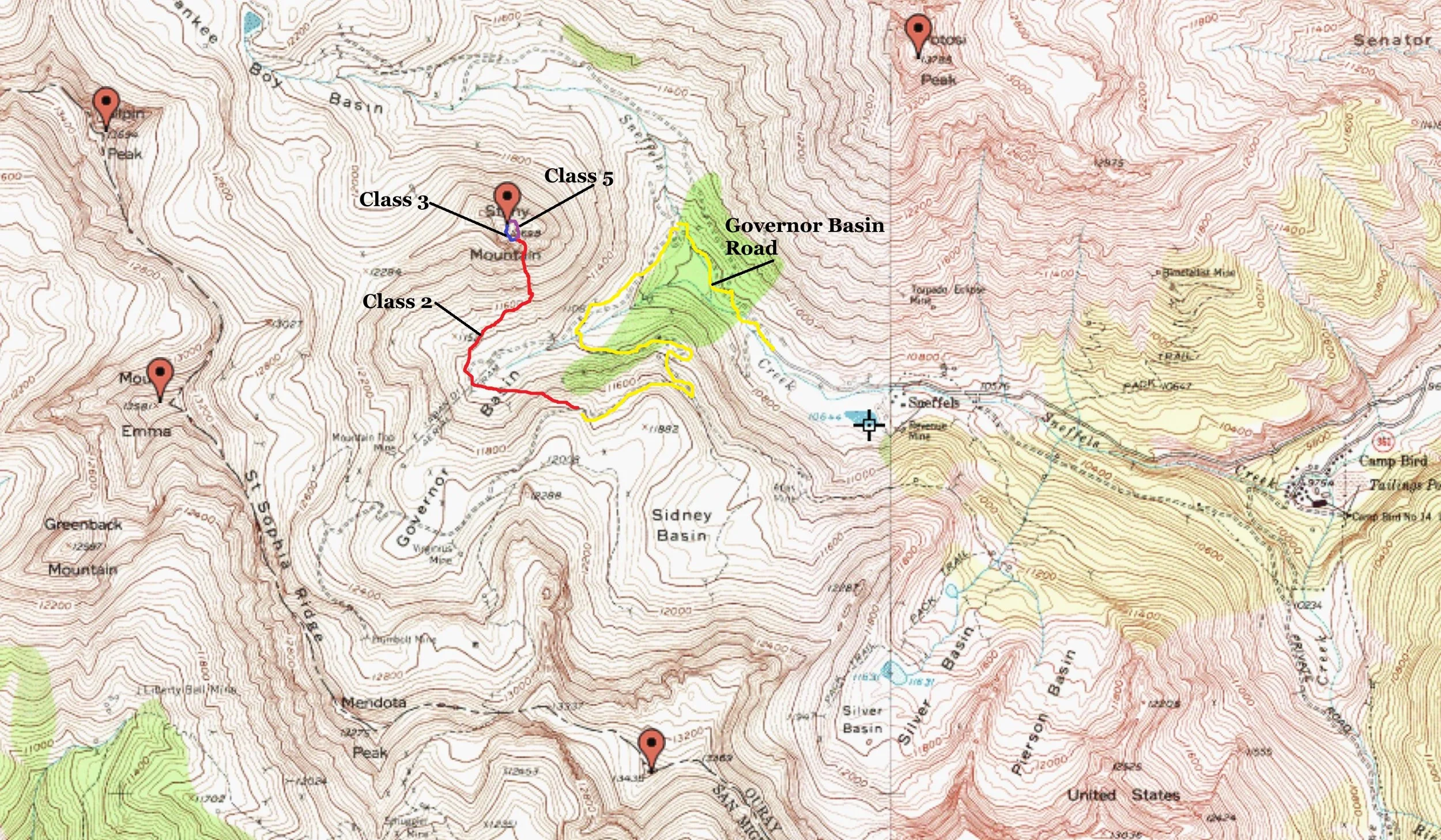
East Face (via Governor Basin)- Class 3 (5.4 bypass)
Trailhead- Pullout near the Virginius Mine
2.92 Miles | 1,596’ gain
Starting elevation- 12,040’ | Ending elevation- 13,592’
Regina Thomas, Kiefer Thomas
A LITTLE HISTORY…
Ferdinand lost his father as a young boy. Instead of being forced into a wildly neglected orphanage system, he opted to live with extended family. As a boy, he was curious, quiet, shy and intense. He developed an interest in the sciences during his impressionable years and when of age, enrolled in university pursuing medical sciences at the behest of family. However, a future in the curative and clinical world wasn’t what fate held for this bright and precocious lad.
Ferdinand Vandever Hayden left the medical world and started to study the natural sciences with an emphasis on naturalism and geology.
On one of his first trips into the field, Hayden traveled to the Dakota Badlands in 1853. He was 24 years old. It was a successful trip that ended up defining the next 30 years of his professional life. In fact, his burgeoning tenacity for preservation, documentation and taxonomy laid the foundations for the US Geological Surveys (USGS).
Hayden was the first individual to ever bring back dinosaur fossils from out west back to Washington DC thus, redefining the current mode of thought on geology and sedimentation.
During Hayden’s earlier years, he co-led and led successful surveys to the Missouri River Basin (several times), The Badlands, Yellowstone and of course, Colorado. In fact, MANY locations in Yellowstone and Colorado were named in honor of his exploits by his peers after his death.
He considered Eastern Colorado of no interest or consequence, likening it to Kansas. Central and Western Colorado, however, were of great interest. Since Yellowstone had no reliable means of transportation and no railroad, even though he held it in greater fascination over Colorado, the lack of infrastructure and cost forced Hayden south into the Colorado Territory (1872-1873).
Along with his good friend and famed photographer, William H. Jackson, the duo surveyed, mapped and detailed many areas in Colorado including: the Buffalo Peaks Range, Weston Pass area, the Northern Sawatch (Holy Cross Wilderness) and of course, the magnificent San Juan Mountains.
On November 9th, 1871, after a year of courtship, Ferdinand married Emma Cooper Woodruff in Philadelphia where he also taught at the university while also moonlighting for the government. They were both in their 40’s and never had any children. Emma was the daughter of a Philadelphia merchant. There is incredibly scant information on who Emma was. But when one is married to such a scientific colossus, it’s easy to disappear in their shadow.
Originally named “Virginia Peak” by the local miners because of its proximity to the Virginius Mine (Lavender, Dwight, 1932), Hayden renamed the peak, Mt. Emma in his journals and maps for his wife. Thankfully, for such a demure and unknown life, her name lives on in the Colorado Parthenon of mountains.
Hayden died in 1887 from the progressive disease, locomotor ataxia. Emma lived until 1934. Both are buried side by side in the Woodlawn Cemetery in Philadelphia.
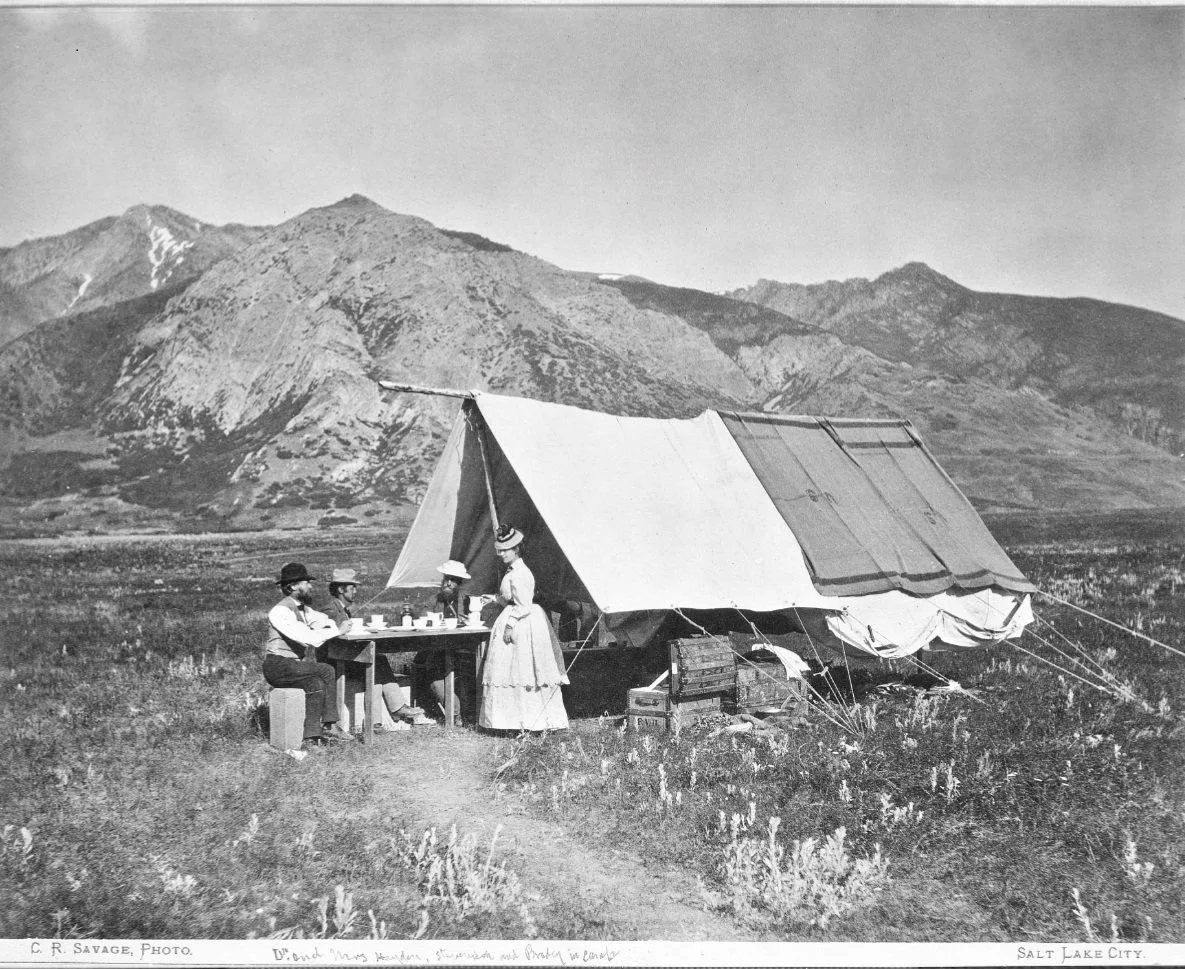
Jackson & Emma relaxing at camp in the Yellowstone Valley
Finally making the upper ridge.

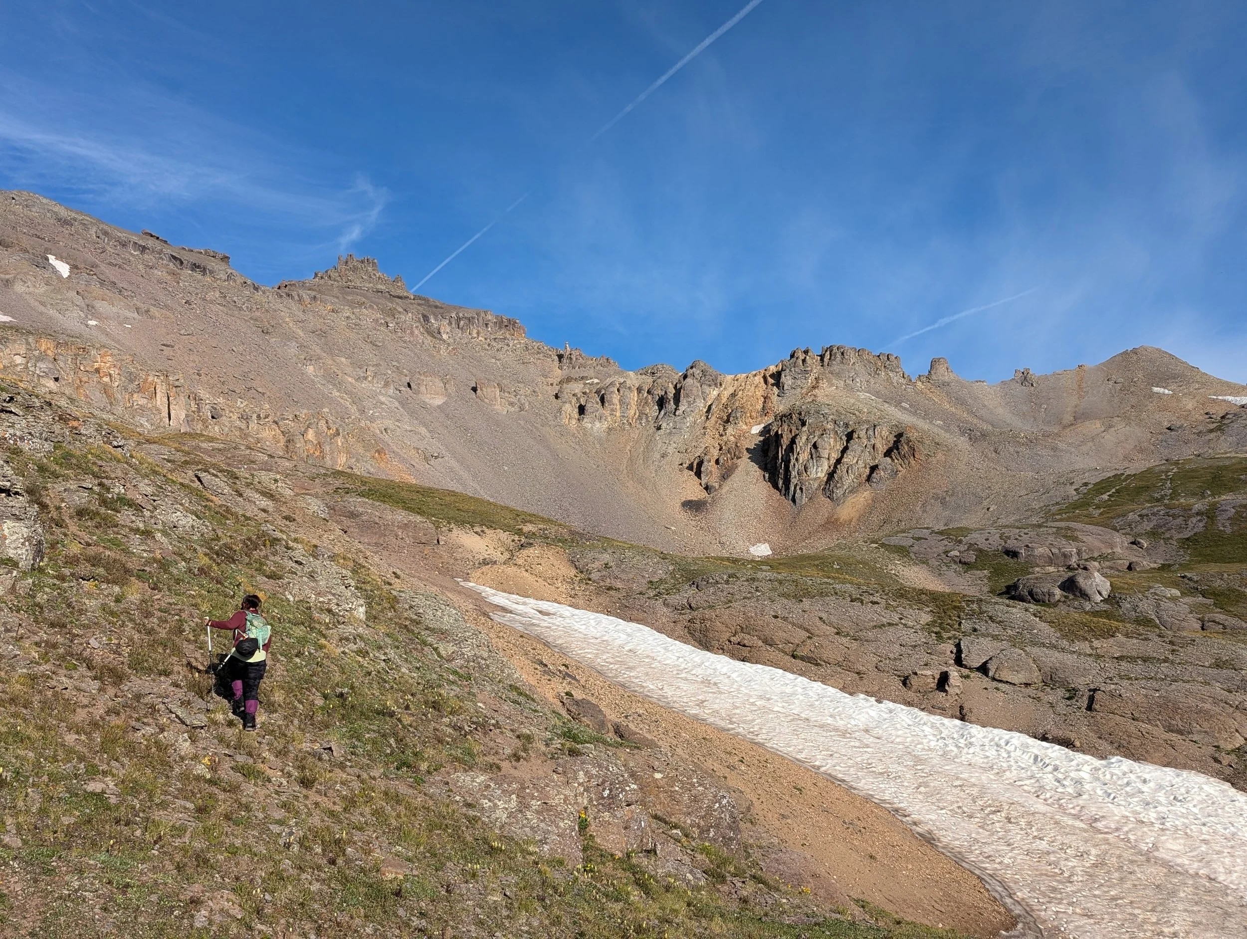
Taking a quick break halfway up the slope

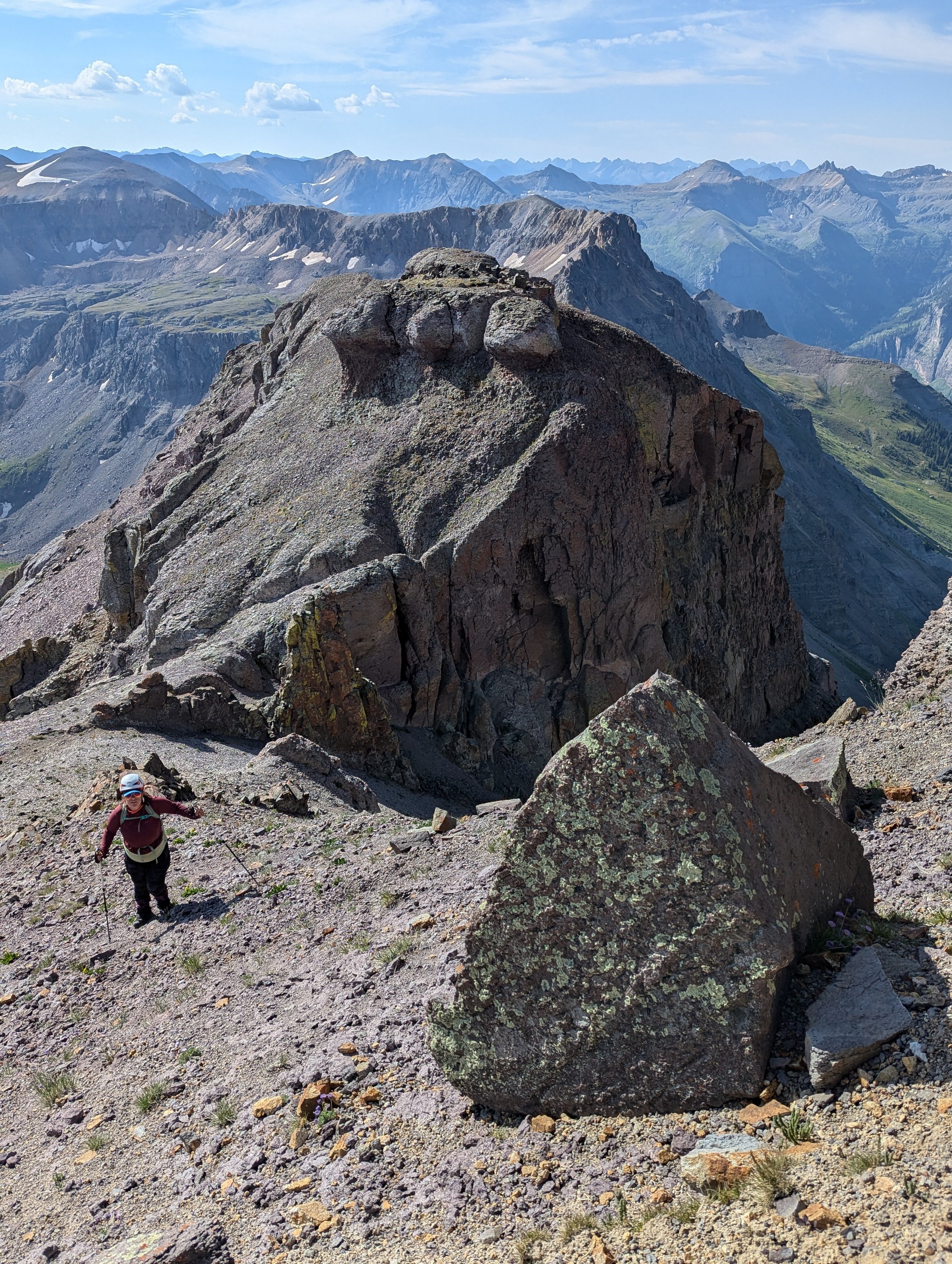
The summit tower on St. Sophia Ridge

"Kismet" 13,703'
I haven’t noticed much accuracy with weather forecasting in the San Juans this year; everything seems upside down. I know that’s a bit of a moot point when mentioning the San Juans. But let’s just say, it’s off more than ‘normal.’ Having said that, even with an 80% precip. forecast, Regina and I felt confident enough that we could sneak up Mt. Emma and be back down to the truck before the storms rolled in. By the way, something I've recently learned, "80%" means that 80% of a given area will experience rain, not that 100% of an entire area will experience 80% chance or rain. Which explains a lot in years past when I have been climbing/hiking in what seems to be an island of calm in skies of storm and stress.
Governor Basin Road is what I’d call an easy 4x4 road. I wouldn’t rate it any harder than perhaps a 2/5. The only thing of note, is that the road overall, is narrow with few places to pull over for oncoming vehicles. It is less visited than Yankee Boy and, in my opinion, considerably more scenic. But after spending over 20 years off-roading, driving Wranglers, Taco’s & Tundra’s and GMC Silverado’s, I judge everything (including Lake Como Road), up against Kelly Flats in Northern Colorado.
We parked at the Virginus Mine and put boots on the ground at 7:10 am. We swam through eddy’s of wildflowers and tundra thick and green as an Olympic Rain Forest. We knew the East Slopes route would gain roughly 1,600’ in 1.6 miles. So going into it, it was going to be a thigh-burner. But for now, frolicking through sedge grass, alpine clover, at least eight different colors of wildflowers and bumblebees like derby cars, I could care less.
But of course, we had to cut our stay short. We soon crossed the rubicon into the cold and resolute world of rock & talus, observing how it devours everything green and animate.
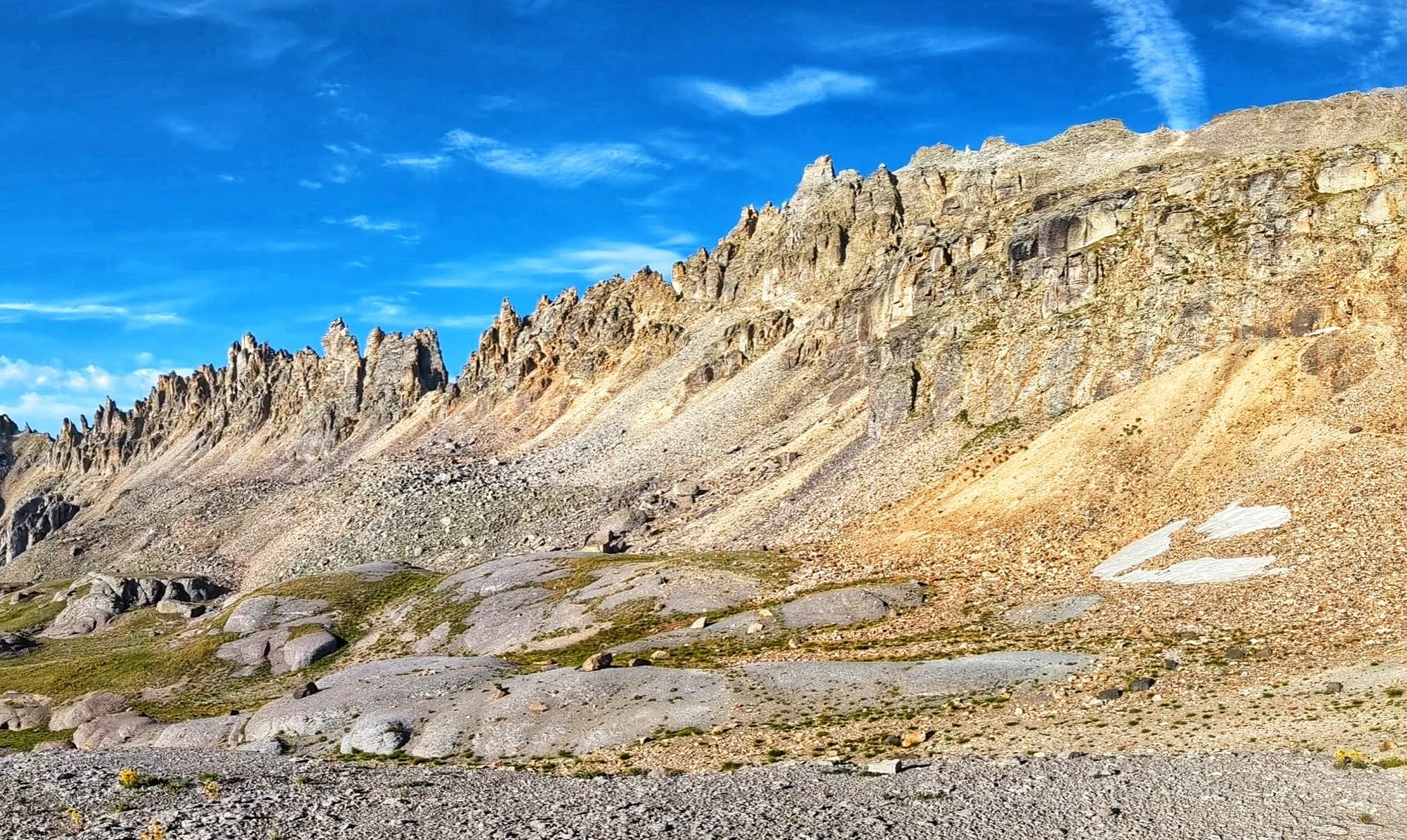
Saint Sophia Ridge
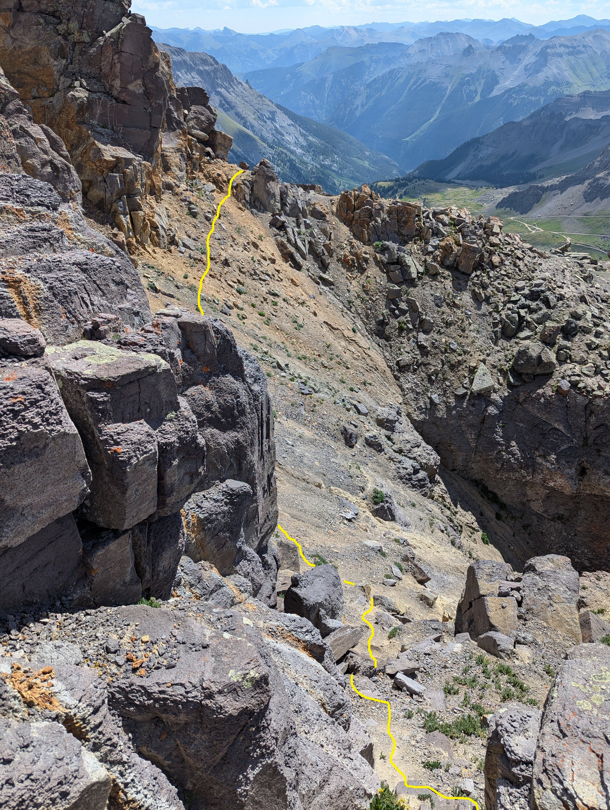
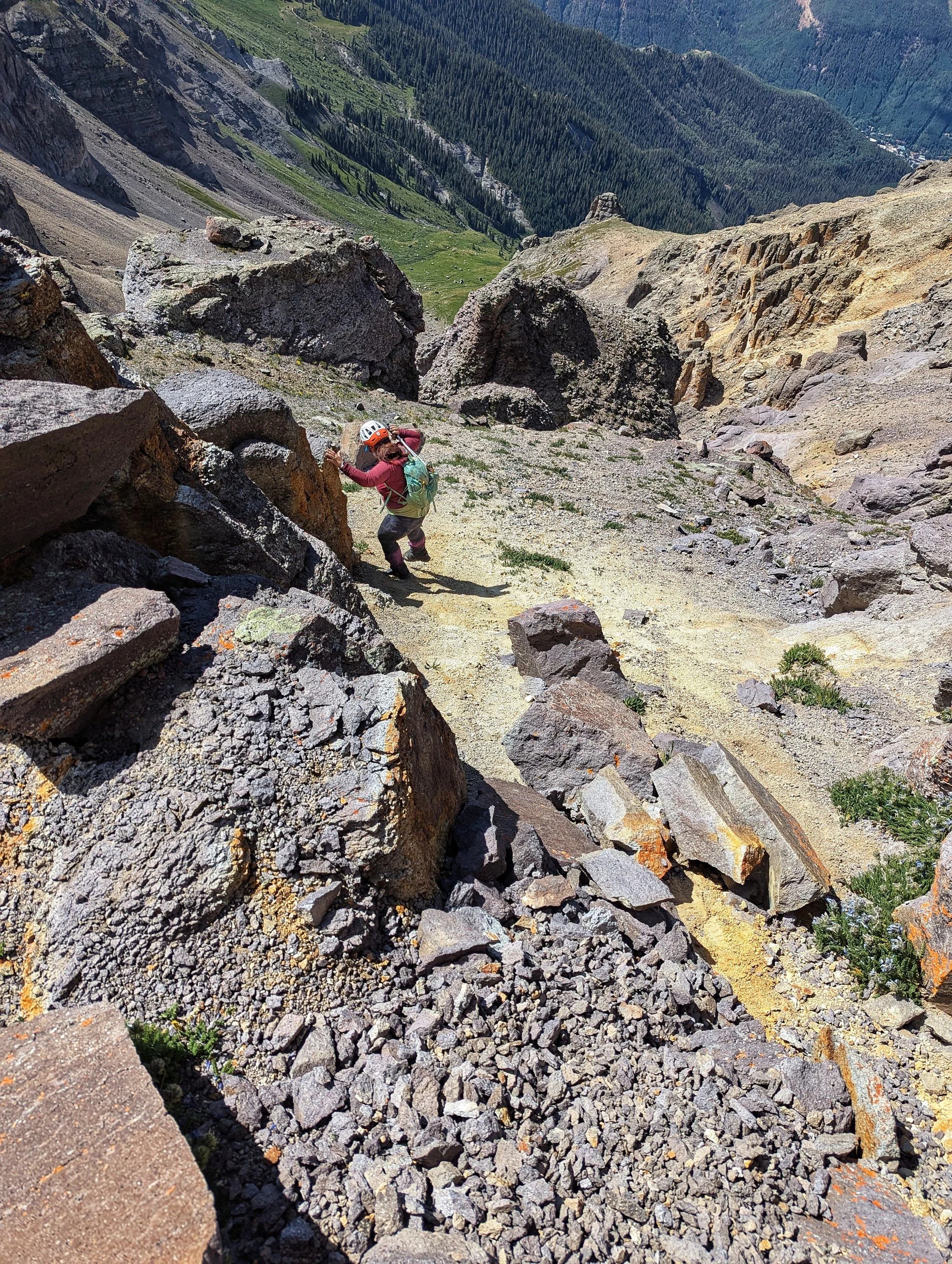
If there’s any singular word that describes Yankee Boy Basin is choss. Any of the peaks in this part of the state, and I’m looking at you, Sneffels Range, will test your futility muscles. The slope leading up to Emma’s upper ridge is about 600’. And it all moves.
We crossed the flat section below, passing a lot of old mining debris and trash (think wire and tin cans). The interspersed dirt soon gave way to all rock, and we were soon gaining elevation. If you even look at a rock the wrong way, it’ll dislodge. The lower part was probably the most solid of this slope. Half-way up, things got extraordinarily loose and stayed that way till the upper cliff band.
There’s really no ‘better way’ up this thing. You’re just going to have to grunt it out. I switch-backed frequently assessing and trying to find a more solid way all to the same result, it’s all garbage. I was finding myself wishing I was on “Coffeepots” slope instead. There is a 100’ or so vertical line of more solid rock that I choose. But even this footing is covered with kitty litter scree. I scrambled up this and waited for Regina at a flat spot.
The views did not suck! Getting up Emma might not have been the most pleasant thing to scale, but man, even with the smoke from the Bucktail Fire (northeast of Nucla) partially washing everything out, I was really enjoying this. I glanced over at Mt. Sneffels and noticed a tower of rock that eerily looked like a person. I thought amusingly that this was Emma. She came back to watch over her mountain and greet every sunrise! We rested for a bit longer so that Regina could catch her breath and bid ‘Emma’ goodbye continuing our upward struggle.
I was having an easier go at it than Regina. But then, I also cut my teeth in the Elks and running the 14ers back in my youth. So as annoying as choss can be, personally, it doesn’t bother me too much. Plus, the fact that I can turn my feet completely sideways doesn’t hurt!
Regina heading up the lower slope in the morning. Our ascent route is to the far right.
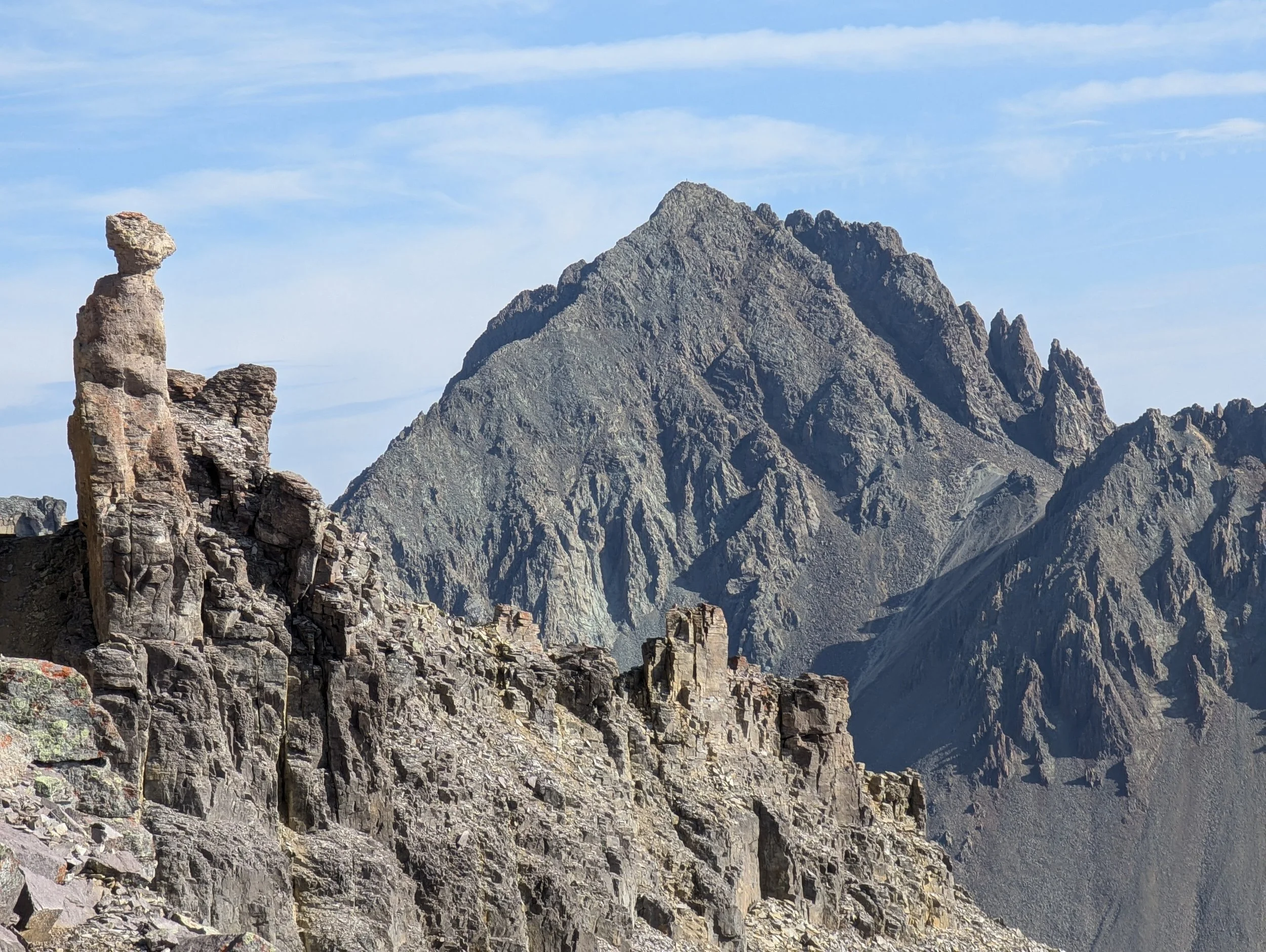
“Emma” watching over Mt. Sneffels
The key to minimizing your time on this slope is to head straight for the towers that you can see from the bottom. Don’t bother looking for a shorter, more solid path, there isn’t any. The towers by the way, is not the summit. However, the closer you get, you’ll see a small but broken cliff band just below the ridge. We approached the cliff band, found a small notch in it and three quick class-3 moves and we were on the ridge. We than walked up to the billowy pinnacles and in the words of Gerry Roach, we “considered our future.”
Something I’ve noticed that more experienced people tend to do, is understate a complex route or a technical route’s difficulty. We downplay the vulgarities. And while I used to do this as well, I’ve since corrected myself. We all look at a route through different eyes, different experiences, different gaits (height) and of course, different risk tolerances. While the actual route up to Emma’s summit isn’t necessarily complex, it can be confusing and there is ample opportunity for something to go wrong. And regardless of if you have 30 years under your belt or three, I’m sure these are "sediments" we can all appreciate.
CLIMBING BETA…
1.) As we looked at the ridge towers, we headed slightly left to a low dirt clearing on the shoulder. Once we were on top, we kept a high traverse across a scree & dirt funnel of sorts aiming for some lower crags & boulders. If we fell on this traverse, we’d definitely take a slide but it’s entirely possible to stop before the cliff/constriction below. Regina checked Laura’s (wildwanderer) report to confirm we were on track. While back at the dirt perch and along the short traverse, there is a prominent yellow gully that ascends through the pillars. It is steep and loose as shit. While Laura climbed this tight gully in its entirety, I found a workaround that cuts off the entire bottom half (and safer).
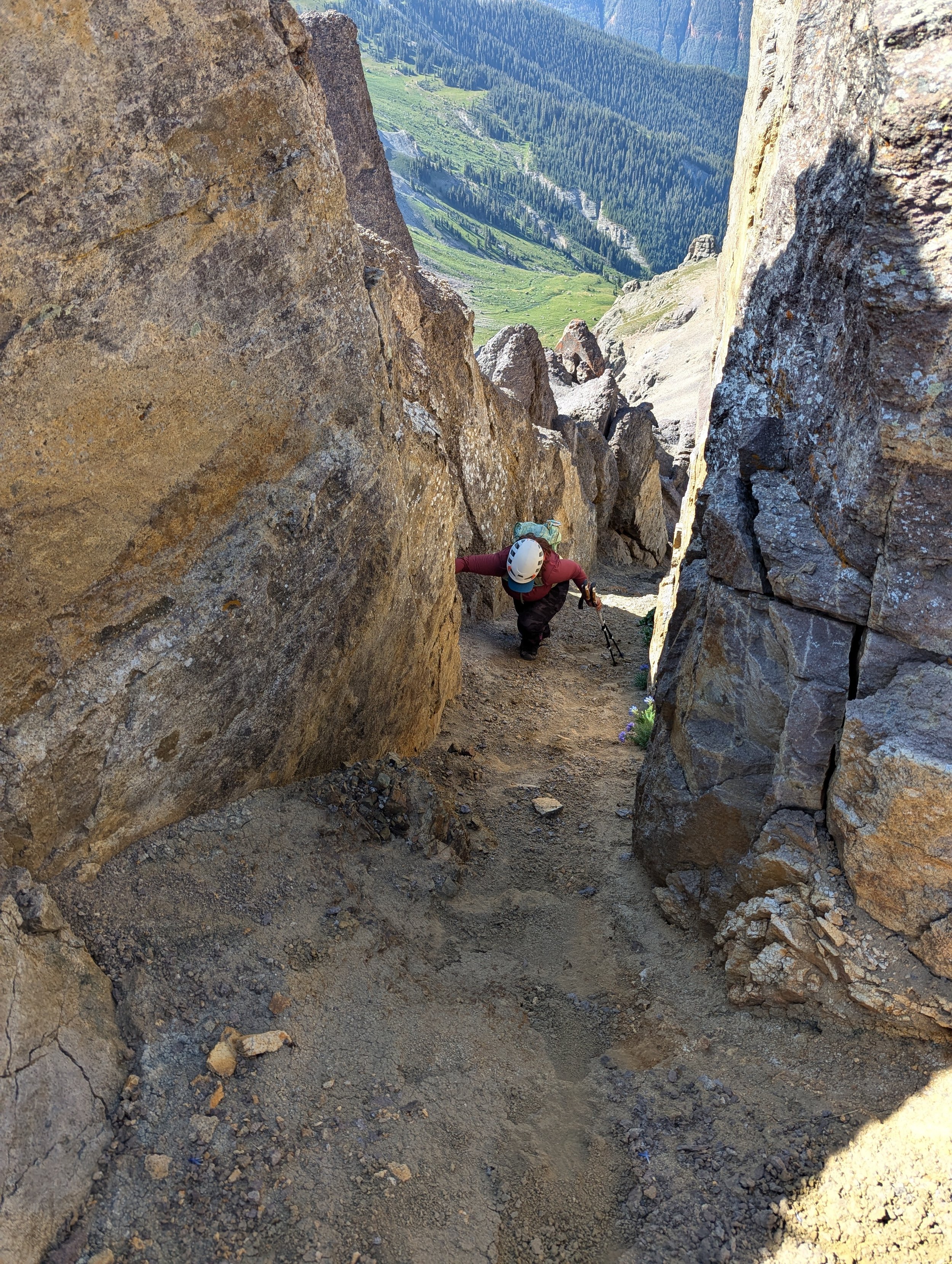
2.) Once we were past the scree funnel, we scrambled up and around the lower boulders/crag and ascended an easy class2+ ramp. This ramp tops out roughly halfway the distance of the first yellow gully. We crab-walked ten feet up the gully to a pair of large (and stable) boulders. Above this was a flat scree shelf. We crossed over and crab-walked/counter pressured for another 20 feet to the top of the gully (class-3). The whole of this first gully is hardpan dirt with kitty litter rock (think Jagged Mountain) strewn all about. If you fall or make a misstep while in the gully, you’re taking a ride! You can stop yourself on the rock but expect to scour the shit out of your hands.
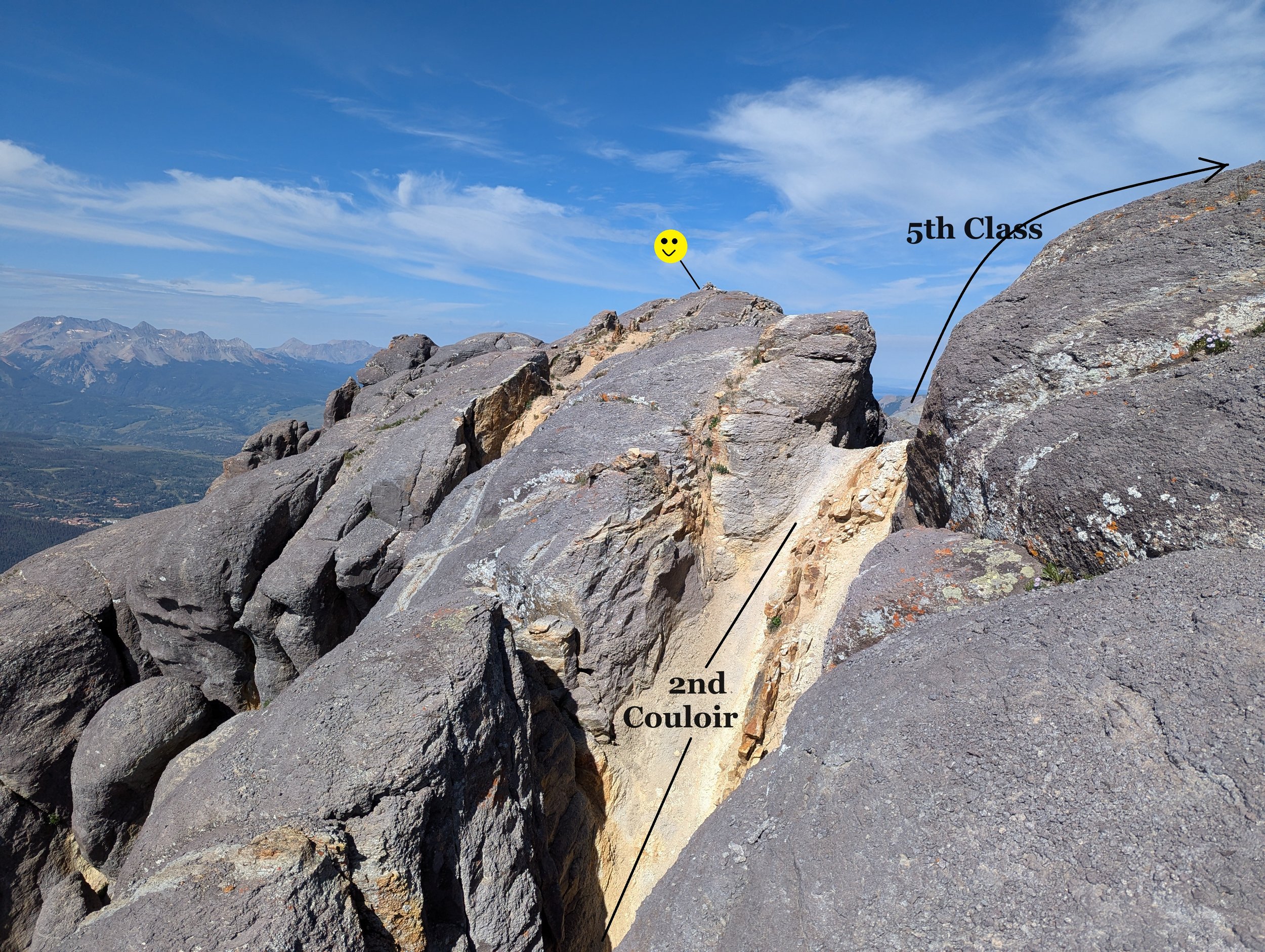
3.) At the top of the gully, the CORRECT path is straight ahead. Do not dogleg to the right and up the prominent dirt gully. Even though the pitch isn’t as steep and traction is markedly better, it dead ends in an alcove that requires 5th class to exit. Instead, descend from the top of the first gully and traverse straight, passing the dirt gully on the right. Just around the corner from the pillowy towers, the second yellow gully will come into view; this is what you want.
4.) Start climbing this second gully (class 3) to the top, which is in view. It’s roughly ¾ the length of the first. It is considerably narrower than the first with a constriction. The rock is rough and like 4-grit sandpaper. It’s very crumbly and expect to mantle & stem to get up it. At the top of the gully, the summit is finally in sight. In fact, you’ll be able to see the cairn (class 2).

The 'Funnel' Traverse
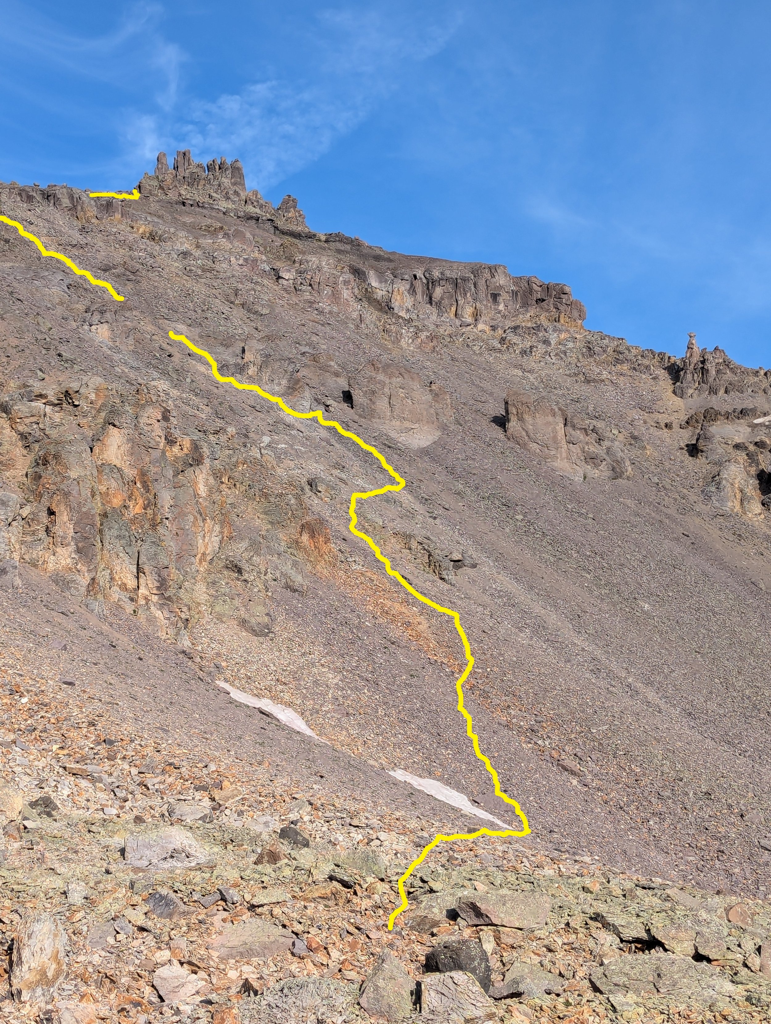
Our approximate ascent route up the choss slope
The summit
Our traverse across the top of the funnel
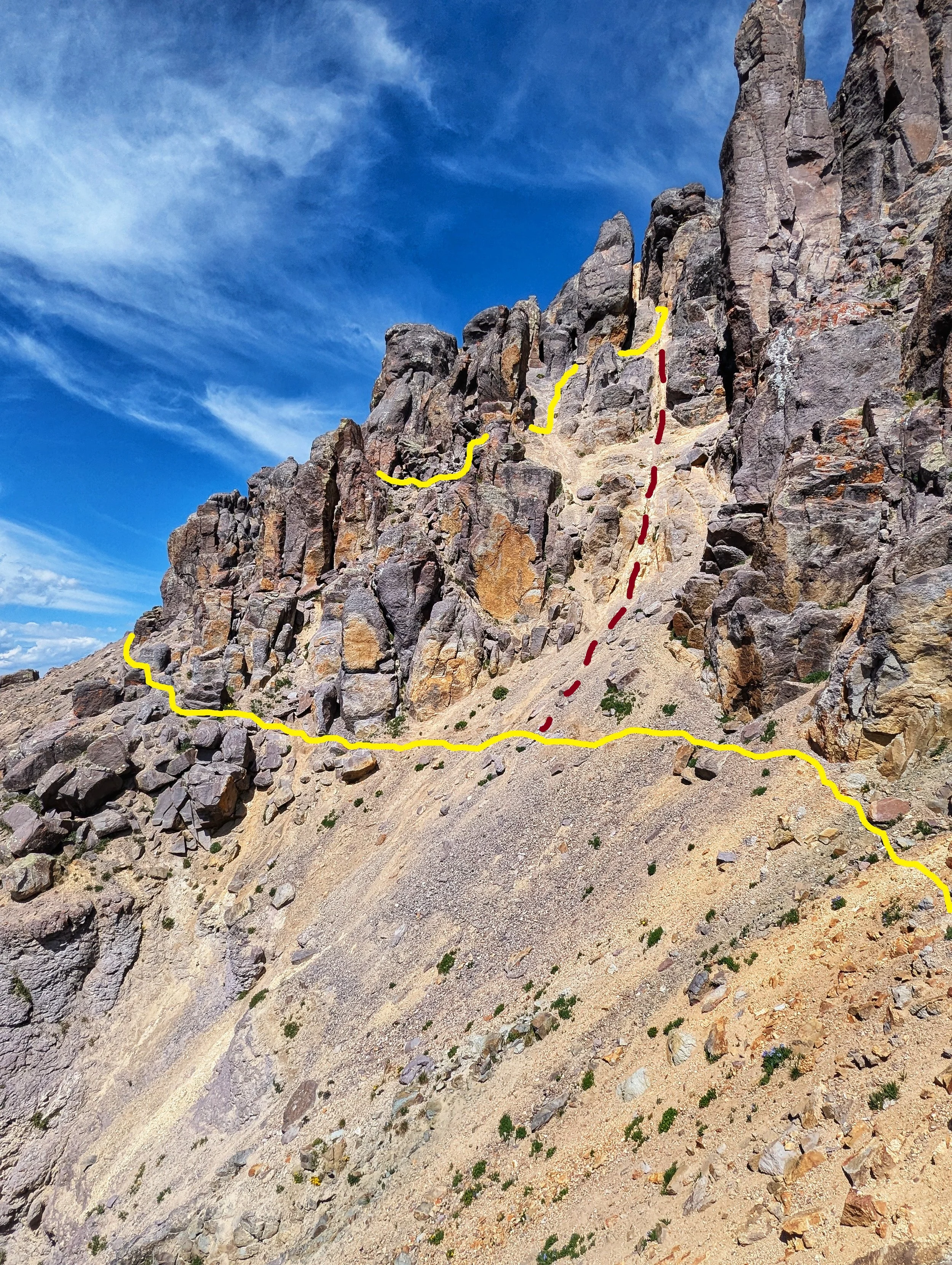
YELLOW- is our route across the loose slope. RED- is the route many others use.
The WRONG gully. You'll know this because of the abundance of dirt and absence of kitty litter rock
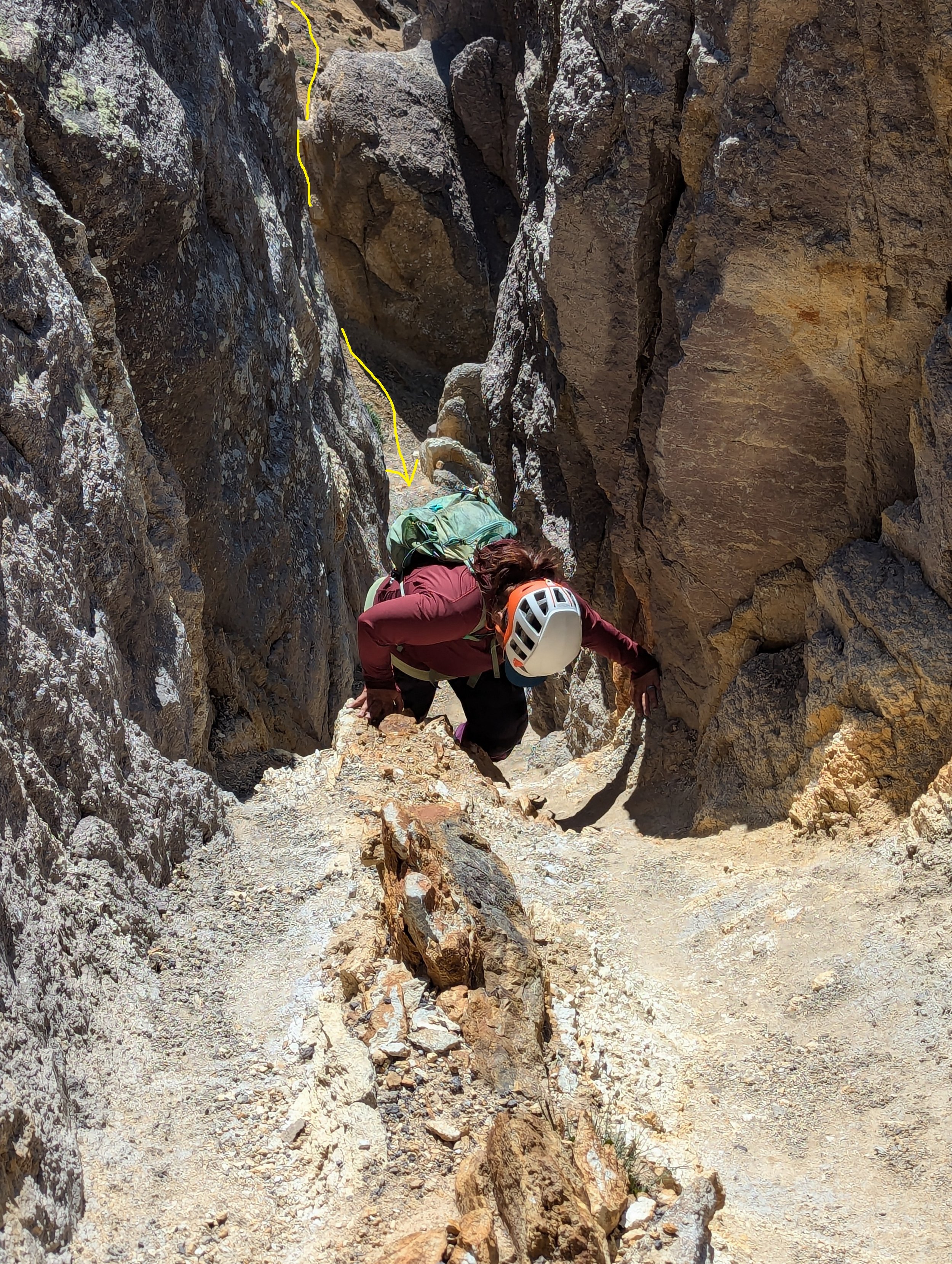
Back at the bottom of the dirt (wrong) gully, Regina and I couldn’t see the second gully from where we were. Since the dirt gully was significantly easier to climb, we naturally gravitated towards that.
I poked around at the top which ended at a small but tight alcove, two people max. I couldn’t find any workaround that didn’t involve 5th class or stupid exposed 5th class. Regina waited at the bottom of this alcove, and I squeezed, and I do mean squeezed my way up in a crack for maybe 15’ of 5.3 climbing. At least that’s my guess. I topped out on top of the pillar and walked back over to the edge. I could see the correct gully we needed. I yelled down to Regina to descend the dirt gully and keep traversing until she saw the second yellow gully. Again, it’s steeper than the first and as she was climbing it, one of her holds crumbled and she almost took a slide back down! She regained her position and joined me at the top. To get off the pillar I was standing on, I had to turn in and perform two quick moves of 5.1. I thought about just jumping down onto the col, but since the rock was so rotten, I didn’t want to chance sliding off the other side; THAT would not have been good.
Regina descending the second gully from the summit

Summit selfie!
Regina descending the lower talus slope
There were some familiar names in the register: Ryan- RyGuy and Otina- 'Bergstiegen', Liba, Alec- ‘Skimo’, Ben ‘Supranihlist,’ and John Prater ‘Homie.’ I put the paper back in the tube and we wrapped up our stay. Weather-wise, we were still fine. But it was raining further north, and we had some massive cauliflower floating just west of us. We retraced our ascent route back to the truck almost verbatim. And we did make it back before the rain started. The first drops fell as I pulled away from the mine.
Once I let hindsight have its say, I actually found Emma to be an enjoyable mountain despite the immense choss. Unlocking the puzzle of the summit towers was gratifying and the views really did make it all worth it. But just heed, a lot can go seriously wrong on this mountain.